Section Branding
Header Content
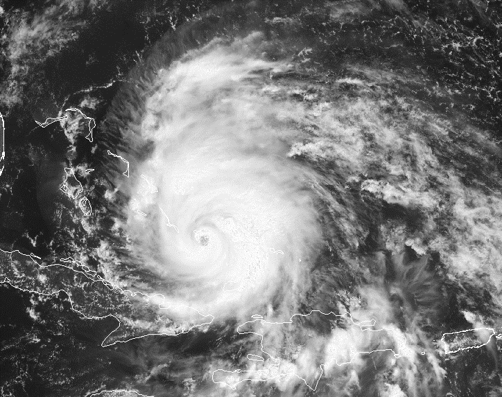
Irene Eyes Bahamas, New England Coast
Primary Content
Hurricane warnings are in effect for the Bahamas as Hurricane Irene continues to move towards the islands.
At 5 p.m. EDT Wednesday, the center of Hurricane Irene was located 215 miles southeast of Nassau in the Bahamas. The storm is moving northwest at 12 mph, and Irene is expected to cross over the islands late Wednesday night through Thursday morning.
U.S. Air Force Hurricane Hunter planes observed maximum sustained winds of 120 mph, making Irene a Category 3 storm. Hurricane force winds were measured 60 miles from the center of the weather system. Forecasters expect the hurricane to grow larger in size and strength, and Irene could become a Category 4 storm on Thursday.
Hurricane Irene is currently expected to make landfall along the North Carolina coast on Saturday afternoon. The official forecast track also suggests that Irene will skirt the Eastern Seaboard on Sunday. Irene is forecasted to make landfall again in New England Monday morning.
For a complete list of hurricane watches and warnings, visit the National Hurricane Center at www.nhc.noaa.gov.
Tags: Georgia weather, Hurricane Irene
Bottom Content