Section Branding
Header Content
UGA Scientist: There Is Oil In Marshes Near St. Simons
Primary Content
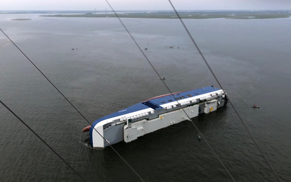
There is definitely oil in the marshes near St. Simon’s island where a shipping vessel capsized this month.
That’s the conclusion of University of Georgia Marine Scientist Mandy Joye and others who sampled the marshes last week.
Years ago, Joye studied the massive Deepwater Horizon spill in the Gulf of Mexico. While Joye said what she and others found near St. Simon’s is not Deepwater Horizon severe, it is spreading. They found little oily tarballs spread across the marshes near the capsized ship, as far as the spot they imagined would be unaffected and which they intended as their experimental control.
The findings would seem to support what the Altamaha Riverkeeper found days earlier.
Joye said while it would seem obvious that the oil they found would have come from the ship grounded since earlier this month, there’s some testing to do to make sure.
“We have to fingerprint it,” Joye said. “Every oil has a unique fingerprint just like a person's fingerprint is unique to the person.”
That will be done with a machine called a mass spectrometer and will require samples of oil and fuel known to have come from the ship itself.
After that, Joye said scientists will begin measuring the environmental impact of the accident.
“We need to know all the marshes that are contaminated, how much material got in there,” Joye said. “So it's a very slow painstaking process. Takes a lot of personnel time, takes a lot of effort. This is just the beginning. I think we have a lot of work to do.”
The Coast Guard said highly fluctuating tides and speedy currents between the marshes and the sea make erecting a single boom around the ship to stop the spread ineffective. Instead, they have rapid responders ready to isolate new oil sheens with smaller booms.
Work to drain the main source of fuel on the vessel is expected to begin in the next few days.


