Section Branding
Header Content
People On The Texas Gulf Coast Brace For Tropical Storm Nicholas
Primary Content
Updated September 13, 2021 at 10:42 AM ET
The Texas Gulf Coast and southwestern Louisiana are under threat Monday, with Tropical Storm Nicholas bringing a "life-threatening storm surge, isolated tornadoes, and significant heavy rain up to 20 inches in places," the National Weather Service said.
Nicholas could strengthen into a hurricane before making landfall on the northwest Gulf coast later Monday, according to the National Hurricane Center. The storm is large, projecting tropical storm-force winds up to 115 miles from its center.
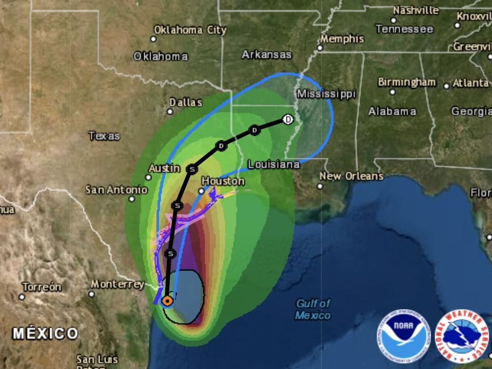
A hurricane watch is in effect from Port Aransas (east of Corpus Christi) to San Luis Pass (south of Galveston). Other alerts include the Houston metro area, which was soaked by Hurricane Harvey four years ago and again by Tropical Storm Imelda in 2019.
Around midday, a weather buoy southeast of Corpus Christi reported sustained winds of 49 mph with gusts up to 56 mph, the NHC said.
The storm is hugging the coastline
Nicholas is currently in the western Gulf of Mexico, roughly 70 miles south-southeast of Port Aransas. The storm has maximum sustained winds of 60 mph and is moving north at 12 mph, the NHC said in its 2 p.m. ET update.
Nicholas may trigger "considerable flash and urban flooding" as it brings total rainfall of 8 to 16 inches, with isolated amounts of up to 20 inches, across coastal areas in middle and upper Texas over several days this week, the NHC said.
For a broader section of the coast, including southwest Louisiana, people should expect to see five to 10 inches of rain, the agency said.
"This is a life-threatening situation," the NHC said, urging people in areas under broad storm surge warnings to act now to protect life and property and to obey any local evacuation orders.
Flash flood risks force schools to cancel classes
People and governments in the storm's path are making preparations. The Houston Independent School District has canceled classes for Tuesday, although students reported to school as normal Monday.
Houston is taking steps to try to minimize the storm's disruptions and risks, erecting dozens of barricades and readying high-water rescue vehicles, according to Houston Public Media.
"We are monitoring this storm very, very closely," Mayor Sylvester Turner said, according to the station.
Houston is taking steps to try to minimize the storm's disruptions and risks, erecting dozens of barricades and readying high-water rescue vehicles, according to Houston Public Media."We are monitoring this storm very, very closely," Mayor Sylvester Turner said, according to the station.
"We are beginning to see high water locations on freeways," the city of Houston announced on Twitter.
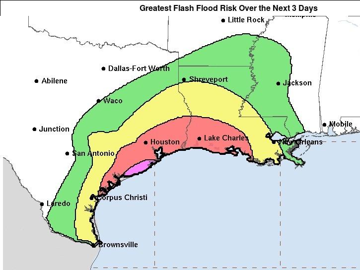
A huge inland swath of the Gulf Coast — reaching from Corpus Christi northward past Houston and extending eastward more than halfway across the Louisiana coastline — is under a "moderate" flash flood risk for the next three days, the NWS warns. A relatively rare warning of a "high" risk of flash floods is in effect for a smaller area that roughly corresponds with the hurricane watch zone.
Nicholas is wiggling and wobbling, forecaster says
As of Monday morning, the storm was moving both slowly and erratically, the hurricane center said.
"It's wiggling or wobbling all over the place," NHC Director Ken Graham said in a briefing about the storm.
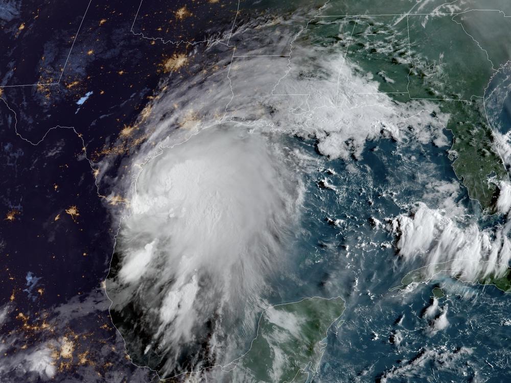
Nicholas is also lopsided: While its center is relatively close to the shore, the bulk of the storm's winds remain far out over the gulf, according to satellite images from Monday morning. And because the system is pushing a massive amount of water far ahead of it to the north, rain bands were already hitting the coasts in Texas and Louisiana early Monday.
Forecasters expect Nicholas to gain a bit of forward speed and move more to the north — a pivot that will largely determine which areas are hit the hardest.
The system is expected to make landfall late Monday afternoon or in the evening. But before it does so, Nicholas will likely move along the shore, dropping significant amounts of rain on the coasts of northeastern Mexico and south Texas, the NHC said.
Climate change has been linked to the more frequent occurrence of intense hurricanes. In addition to strong winds, many of the most dangerous storms in recent years have brought tremendous amounts of rain – creating new threats to people and infrastructure far inland from the coast.
Copyright 2021 NPR. To see more, visit https://www.npr.org.


