Section Branding
Header Content
California, hit by a 2nd atmospheric river, is bracing for floods again
Primary Content
California is expected to see another bout of rain and snow through Wednesday.
The heavy downpour, which is forecast to intensify late Monday, is the result of an atmospheric river. It's the second to hit the West Coast in under a week's time.
Parts of central and southern California are expected to see excessive rainfall and possibly flash floods through Wednesday morning. Areas with high elevation in northern and central California, as well as northwest Nevada and Oregon, will receive snow, according to the National Weather Service.
The combination of heavy rain and snow melt is also expected to produce widespread flooding starting Tuesday. Creeks and streams will also be vulnerable to overflowing, particularly to larger rivers.
On Sunday night, California Gov. Gavin Newsom declared a state of emergency in six additional counties: Calaveras, Del Norte, Glenn, Kings, San Benito and San Joaquin, to offer more resources to those areas. Newsom had already issued emergency declarations for 34 counties over recent weeks.
Meanwhile, on the Northeast coast, a major nor'easter is developing starting Monday night through Wednesday. The snowstorm is expect to produce strong winds up to 50 mph, as well as two inches of snow per hour in some areas. The NWS forecasts that the grueling weather will impact the I-95 corridor from New York City to Boston.
Flood watch in effect for parts of Southern California
Parts of southern California are expected to see nearly 4 inches of rainfall, and up to 6 inches in the foothills.
San Luis Obispo and Santa Barbara will be under a flood watch from Tuesday morning through the evening. The two counties, along with mountains in Ventura and Los Angeles, are expected to receive strong winds gusts of 3o to 50 mph.
The NWS said to prepare for travel delays due to flooded roadways and mudslides. There is also a risk of downed trees and power lines causing outages.
Concerns about flooding will continue even after rainfall weakens on Wednesday
Northern California is forecast to see wind gusts of up to 50 mph in the valleys and up to 70 mph near the coastlines.
The powerful winds in San Francisco and the central coast are likely to damage trees and power lines. The NWS warned of widespread power outages and road blockages as a result. Concerns about the wind will intensify Monday night through Wednesday morning.
Meanwhile, Sacramento and northern San Joaquin Valley are expected to see isolated thunderstorms.
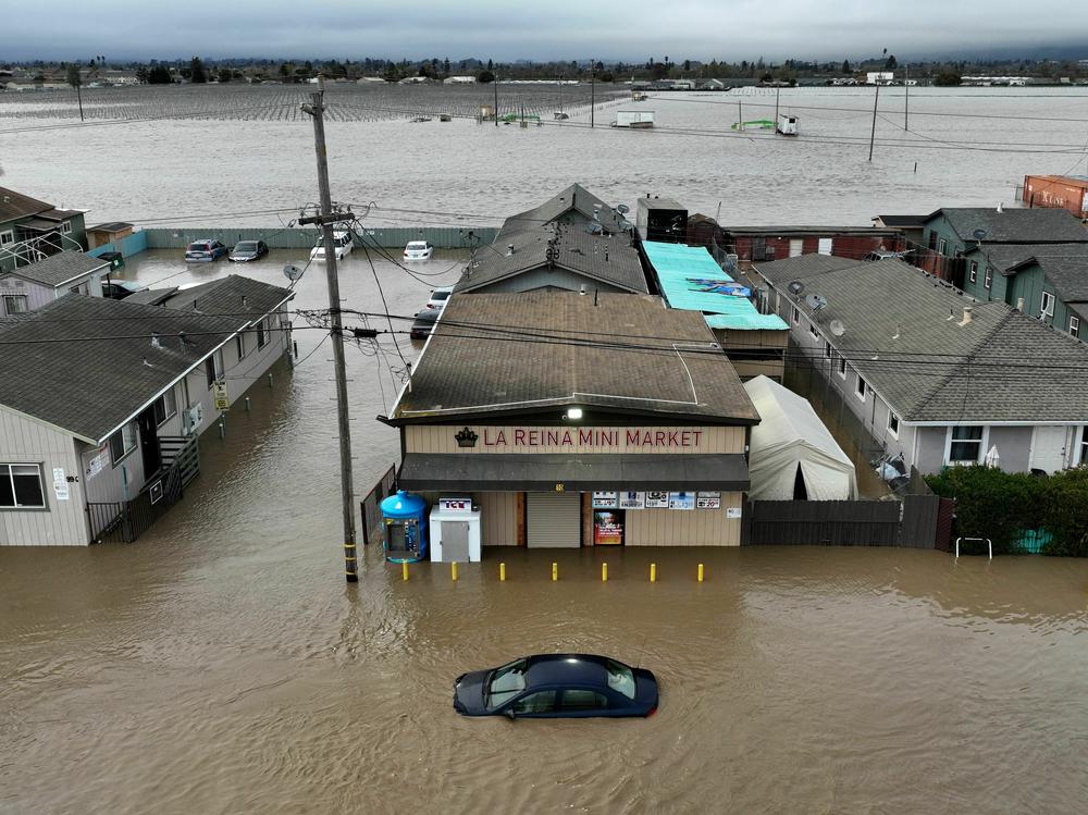
Monterey County, where hundreds of residents were urged to evacuate because of intense flooding, will be at risk of intense rainfall again this week.
"Extensive street flooding and flooding of creeks and rivers is likely," the NWS wrote in its flood watch report. "Lingering impacts from last week's flooding is likely to get worse with this second storm."
Although the rainfall is expected to lighten by Wednesday, forecasters predict that residual flooding will continue to be a concern through early Friday as water makes its way downstream through the rivers.
Copyright 2023 NPR. To see more, visit https://www.npr.org.
Bottom Content


