Section Branding
Header Content
Climate change makes Typhoon Mawar more dangerous
Primary Content
Updated May 23, 2023 at 8:51 PM ET
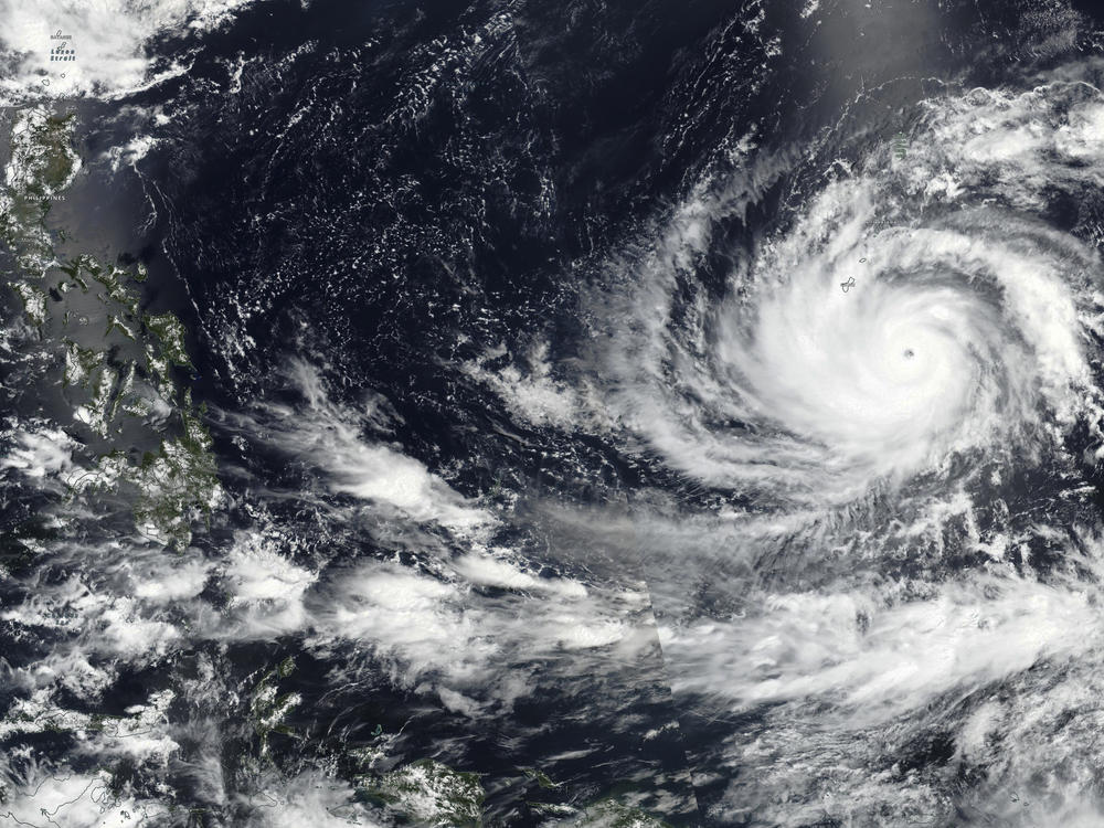
Typhoon Mawar is barreling toward the United States territory of Guam. It is pushing a wall of water in front of it, and packs winds powerful enough to snap power poles and uproot trees.
Climate change makes storms like Mawar more likely.
The ocean soaks up most of the extra heat that is trapped near the Earth's surface by human emissions of greenhouse gasses. The warmer ocean waters are fuel for storms, helping them get large and powerful like Mawar. As the storm approached Guam and the Mariana Islands on Tuesday, the National Weather Service described Mawar as a "triple threat" with powerful winds, torrential rain and "life-threatening storm surge."
Mawar has rapidly gained strength as it moves toward land. In just one day, it went from a Category 1 storm, with winds that might remove a few shingles, to a Category 4 storm with winds powerful enough to tear away roofs entirely.
Such rapid intensification is increasingly common. And storms that gain strength quickly can be extremely dangerous because there is less time to warn people in harm's way. Last year, Hurricane Ian ballooned into a devastatingly powerful storm shortly before hitting Florida. In 2021, Hurricane Ida gained strength right before making landfall in Louisiana.
Typhoons are the same thing as hurricanes and cyclones. Different regions of the world use different words for the spinning storms.
Climate change may make rapid intensification more likely
Scientists are actively studying the connection between human-caused climate change and rapid intensification of cyclones worldwide.
Because heat is fuel for hurricanes, it makes sense that persistently warm water at the surface of the ocean would help fuel large, powerful storms. But wind conditions also affect how quickly a storm grows in strength, which makes it more difficult for scientists to pinpoint the effects of climate change on the formation of any one storm, and to predict long-term trends.
Still, a growing body of research suggests that storms are more likely to rapidly grow in strength as the Earth heats up. A 2019 study found that storms that form in the Atlantic are more likely to get powerful very quickly as the Earth heats up. A 2020 study found a similar trend in the Pacific.
Typhoon Mawar moved over abnormally warm water in the Pacific as it intensified. Oceans around the world are experiencing record-breaking temperatures this year.
Climate change makes flooding more likely, and more dangerous
As dangerous as Typhoon Mawar's winds will be, it is water that poses the largest risk. Storm surge can scour the land, removing buildings, vegetation and everything else in its path.
As Mawar approached Guam on Tuesday evening local time, forecasters predicted between 6 and 10 feet of storm surge, or even higher water if the eye of the storm passes very close to land. That would cause life-threatening flooding.
On top of that, forecasters are warning that Mawar will bring torrential rain of up to 20 inches, which would cause flash flooding farther inland.
Climate change makes both storm surge and inland flooding more severe. Storm surge is more dangerous because of sea level rise. The water along the coast is higher than it was in the past, which exacerbates the damage from storm surge. Guam and the Mariana Islands are especially vulnerable to rising seas because they are low-lying island territories.
And a hotter Earth also makes torrential rain more likely, because a warmer atmosphere can hold more moisture. When a storm hits land, all that water vapor falls as rain. Research has already shown that past storms dropped more rain because of climate change.
Copyright 2023 NPR. To see more, visit https://www.npr.org.

