Caption
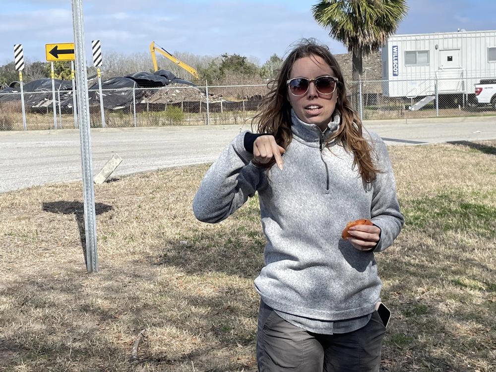
Rachael Thompson, executive director of Glynn Environmental Coalition, discusses the Terry Creek Dredge Spoils Superfund site.
Credit: Mary Landers/The Current

Rachael Thompson, executive director of Glynn Environmental Coalition, discusses the Terry Creek Dredge Spoils Superfund site.
Mary Landers, The Current
No sign tells you you’ve arrived at a Superfund site, but Rachael Thompson, the executive director of Glynn Environmental Coalition knows the four Brunswick-area ones well and regularly takes curious local citizens on tours of them.
“We were founded in 1990 by a group of concerned citizens that was wondering how we had so much pollution in our environment, why we continue to have high levels of health-threatening pollution, and what they could do about it,” she told a group of nine intrepid residents on a nippy Saturday morning in February. “So the fact that you’re here today means that you share that concern, and you share that interest in educating yourselves and being a part of the change that we want to see in our communities.”
Carpooling from site to site, Thompson spent the morning explaining about the federal law that governs the cleanups and how the individual sites got contaminated in the first place.
The Superfund law, more officially The Comprehensive Environmental Response, Compensation and Liability Act, was passed in 1980 to identify and clean up toxic waste sites throughout the U.S. It arrived on the heels of sweeping environmental legislation including the Clean Water Act as well as environmental activism by ordinary citizens, notably Lois Gibbs, whose efforts led to the clean up of the Niagara Falls neighborhood of Love Canal.
The Superfund was initially well funded with taxes on the chemical and petroleum industries.
“It was a super fund, like a literal super fund of money,” Thompson said. “And it was all intended to go to community cleanups to get the hazardous waste out of these out of these communities.”
In 1995, however, then-Speaker of the House Newt Gingrich discontinued its polluters-pay funding.
Since then the money for the Superfund program has come mainly through appropriations from the general revenue, Environment America reports. In recent years, the Bipartisan Infrastructure Law invested $3.5 billion in environmental remediation at Superfund sites, — though none in Georgia — and the Inflation Reduction Act reinstated the Superfund petroleum tax, adjusts the tax rate for inflation, and adds a cost-of-living adjustment for future years. It’s expected to generate $11.7 billion in revenue over a decade, EPA reports.
One of the Superfund “tourists” in February, Ann Pequigney, was already a fan of Thompson and the GEC and had attended its online forum about hazardous waste.
“That prompted me to actually want to physically drive around and see where these places are,” she said.
John Cowlishaw, an area resident for seven years, was already environmentally engaged before the tour. He’s a pilot who’s volunteered to fly for the nonprofit South Wings, a nonprofit that partners with conservation groups for an aerial view of environmental issues. He knew the Superfund sites were there, but got a broader perspective on their history from the tour.
“I’ve really tried to try to be a good citizen and becoming a Georgian trying to find out all things Georgia,” he said.

The Brunswick Wood Preserving Superfund Site, Feb. 7, 2024, Brunswick, GA.
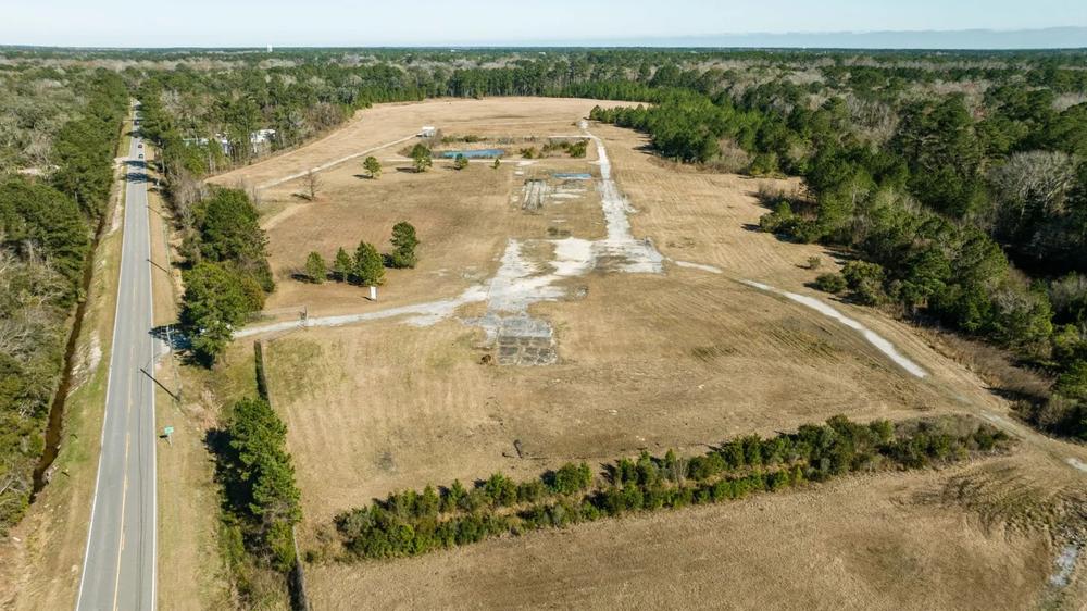
The GEC tour’s first stop was Brunswick Wood Preserving, a flat, fenced field dotted with a few trees; yellow PVC-pipe test wells; and a mammoth, rusty auger. The wood preservative creosote, used onsite for railroad ties and telephone poles to lengthen their lives, had left behind arsenic and copper, among other pollutants. “This site is all the way through the clean up process,” Thompson said.
The site lays between two railroad lines, making it prime for industrial redevelopment. The biggest problem now is its lack of ownership.
“This site is actually what we call an orphan site, which means that it does not have an owner,” Thompson said. “If you look at who owns this property, it’s Brunswick, Escambia, which is the name of the business owner, the LLC, that owned this property back in the day. They administratively dissolved, filed bankruptcy, they don’t exist anymore. But if you go to the tax records, they still own it. So what does that mean? No one actually owns it.”
Because there is no polluter and there’s no responsible party, there’s no one for the EPA to go back to and charge the bill, except taxpayers.
Name: Brunswick Wood Preserving
Location: Perry Lane Road
Size: 84 acres
When listed: Place on the National Priorities List in 1997
Cause of contamination: From 1958 until 1991, a wood treatment facility operated at the site. Operations included the three major types of wood treating: creosote, pentachlorophenol (PCP) and chromium/copper/arsenic (CCA). In 1989, a major spill of diesel fuel, contaminated with pentachlorophenol, occurred into Burnett Creek on the western end of the site.
Of interest: The site’s redevelopment is impeded by the fact that no one officially owns it.

The LCP Chemicals Superfund Site, Feb. 7, 2024, Brunswick, GA.
Next up was LCP, the largest of Brunswick’s Superfund sites.
“Most of the the site is on marsh because of the level of contamination that they put into the marsh. So it’s 813 acres total,” Thompson said. “And 80 is actual developable land.”
Manufacturing activities, including an oil refinery, a paint manufacturing company, a power plant and a chlor-alkali plant, contaminated the site, which sits next to a highly visible landmark in Brunswick, the Georgia Pacific Cellulose Mill.
“The EPA actually went in and shut down this facility,” Thompson said as tour members gazed across the marsh. “When the EPA went on site that day, to close the facility down, they were wearing Class D hazmat suits, which is respirators, you know, every part of their body is covered… there was elemental mercury on the ground.”
GEC and other activists have struggled to ensure that local anglers know of the seafood consumption advisories in the area. The site has a list of about 150 chemicals of concern, with the main ones being are mercury, a neurotoxin, and PCBs (polychlorinated biphenyls), a probable carcinogen.
Name: LCP Chemicals
Location: 4014 Ross Road, Brunswick.
Size: 813 acres
Cause of contamination: Manufacturing activities, including an oil refinery, a paint manufacturing company, a power plant and a chlor-alkali plant, caused contamination at the site.
When listed: Placed on National Priorities List: 1996
Of interest: EPA endorsed a tract of site property as ready for reuse and Glynn County used the opportunity to build a new $27.4 million dollar, 610-bed county detention center. The facility opened in late September 2014.

Hercules 009 Landfill Superfund Site, Feb. 7, 2024, Brunswick, GA.
The tour heads next to the Hercules 009 Landfill, the smallest of the sites. Hercules’ predecessor made ammunitions. After WWII, demand decreased. “And so they transitioned their manufacturing to making toxaphene, which is a pesticide similar to DDT, very persistent in the environment, very toxic,” Thompson explained.
The fenced, nearly 17-acre site sits next to a new housing development, Beverly Villas. Hercules dumped its waste at the north end of the site. After it was determined to contain toxic chemicals it was named a Superfund site.
“The main problem at this site was the landfills themselves, and then some outstanding groundwater issues from the chemicals in the landfills leaching off site,” Thompson said.
Name: Hercules 009 Landfill
Location: Benedict Road and Route 25
Size: 16.5 acres
Cause of contamination: From 1948 through 1980, Hercules, Inc. used 7 acres at the northern end of the site, known as the 009 Landfill, to dispose of waste.
When listed: Placed on National Priorities List in 1984.
Of interest: Hercules used the site as a landfill but did so before pollution control techniques were developed, like impervious liners, to prevent hazardous materials from leaching out of the landfill.

Clean up at the Terry Creek Dredge Spoils/Hercules Outfall Superfund site, Feb. 7, 2024, Brunswick, GA.
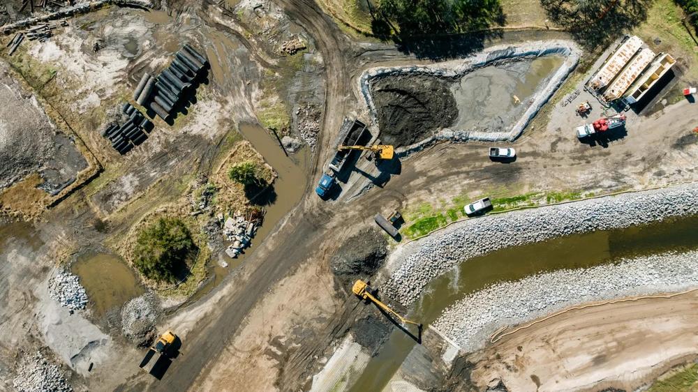
Hercules is also the responsible party for the last site on the tour, the Terry Creek Dredge Spoils/Hercules Outfall site. The site consists of four source areas — three disposal areas and the outfall ditch — in between the Hercules Brunswick facility and the Back River. These areas are contaminated with toxaphene, a chlorinated pesticide, caused by discharges by Hercules LLC (formerly known as Hercules Incorporated) during the manufacturing of toxaphene from the former pesticide plant. Thompson recounted how a ditch running through the marsh became contaminated first by the munitions manufacturing then by pesticides.
“So we’re talking about over 110 years of industrial waste that was dumped there, largely unregulated up until the ’70s and ’80s,” she said.
That contamination was spread through the marsh by dredging, and then animals like shrimp that foraged in the marsh.
“The unfortunate part is when you tell people that it’s just over 200 acres, and they’re working on two acres, people are like, ‘you gotta be kidding me.’ But again, we have to acknowledge that they’re trying to address the most contaminated area first.”
The site is in the Superfund alternative program.
“At any point in time, if Hercules decides to dip out and be like, we don’t want to do this anymore, the EPA is going to be caught in court battling for them to come back to the table. So they do have to make compromises. But what I also tell people is, generally, the EPA is always going to be looking at the risk assessments, that’s the basis of everything that they do. So if they can get the polluter to do something that eliminates the risk based on what the property is now, and that’s what they’re gonna do.”
Name: Terry Creek Dredge Spoils/Hercules Outfall
Location: Near the confluence of Terry Creek, Dupree Creek, and the Back River, north of the Torras Causeway and east of U.S. Highway 17.
Size: 216 acres
Cause of Contamination: contaminated with toxaphene, a chlorinated pesticide, caused by discharges by Hercules LLC (formerly known as Hercules Incorporated) during the manufacturing of toxaphene from the former pesticide plant.
When listed: The site was proposed to the National Priorities List (NPL) in 1997. However, the site was never finalized on the NPL. Instead, EPA uses the Superfund Alternative Approach (SAA) at the site in cleanup settlement agreements.
Of interest: The U.S. Army Corps of Engineers inadvertently spread the contamination when it periodically dredged areas of the site to maintain access, including Dupree Creek and Terry Creek, and placed the dredged sediment in several areas near the merging point of Dupree Creek and Terry Creek.
This story comes to GPB through a reporting partnership with The Current.