Section Branding
Header Content
Heat and snowfall, rain and wildfires. It’s a week of extreme weather in the U.S
Primary Content
The U.S. is experiencing a number of extreme and varied weather events at once, from the prolonged heat wave scorching the Northeast to the deadly wildfires blazing in New Mexico to the tropical storm drenching Texas’ Gulf Coast.
The National Weather Service’s Weather Prediction Center said that heavy rain and flooding in South Texas will gradually decrease on Thursday as Tropical Storm Alberto — the first of the Atlantic hurricane season — dissipates over Mexico, where it made landfall in the morning.
At the same time, thunderstorms are expected to bring rain and flash flooding across the Northern Plains to the upper Midwest.
“All these rain and thunderstorm areas are taking place along the periphery of an upper ridge/heat dome that edges from the Mid-Atlantic into the Mid-South over the next couple of days and sustains a heat wave across the Great Lakes, Northeast, and Mid-Atlantic,” the NWS explained.
Heat domes can last anywhere from a few days to a few weeks. And they’re among the many extreme weather events, including storms and droughts, that are becoming more common and intense as a result of climate change.
Here’s what else the U.S. is seeing — and bracing for — this week:
A heat wave broke records in New England
The first heat wave of the summer struck earlier this week, sending temperatures soaring from the Midwest to New England.
Parts of Maine, Massachusetts, Connecticut, New Hampshire and Vermont, among others, shattered temperature records, some that stood for more than 100 years.
On Wednesday, Caribou, Maine — just south of the Canadian border — hit a record 103 degrees, nearly 10 degrees warmer than Miami.
Millions of Americans in 15 states were under heat advisories as of late Wednesday. The NWS warned Thursday that heat index readings will peak at 100 to 105 degrees in many locations.
Forecasters say record warm overnight temperatures will prevent natural cooling, and are urging everyone — especially people without air conditioning — to take steps to stay safe.
Here are the latest key messages for the Eastern U.S. heat wave through the end of the week and into the weekend. pic.twitter.com/EoOe5SONqJ
— NWS Weather Prediction Center (@NWSWPC) June 19, 2024
The NWS expects the heat wave to peak in New England and the eastern Great Lakes on Thursday, and in the mid-Atlantic and Ohio Valley on Friday.
Temperatures are also predicted to rise in the west on Thursday and Friday before reaching triple digits in California’s Central Valley and Great Basin over the weekend.
Meanwhile, the Rockies got snow
As the eastern part of the country was sweating through record high temperatures, a snowy system sent temperatures plunging in the northern Rockies.
Parts of Montana and Idaho were under a winter storm warning earlier this week, and nearly one million residents of the West were either under a winter weather or frost advisory on Monday morning.
USA Today reports that temperatures dipped to 45 degrees in Great Falls, MT., breaking a nearly 130-year-old record.
Areas of higher elevation, including the Showdown ski mountain, were hit with snow. And the cold front continued into Wednesday, the last astronomical day of spring, breaking more records across Montana.
It was a battle of the seasons as the eastern U.S. sweltered under heat advisories while parts of the West saw June snowfall on Monday. ☀️❄️ https://t.co/sqjbCt90ua
TikTok/livelovebrad
Twitter/@HoldinMoss pic.twitter.com/vqZ2CJXWtK— AccuWeather (@accuweather) June 18, 2024
It’s not uncommon for the Rockies to see snow well into June, though AccuWeather notes that it’s less common this late in the month.
The NWS says temperatures across the state “will warm well above normal this weekend,” with some areas even poised to approach daily record highs.
Wildfires are blazing across New Mexico and California
Several wildfires broke out across New Mexico and California this week, burning thousands of acres and prompting evacuation orders.
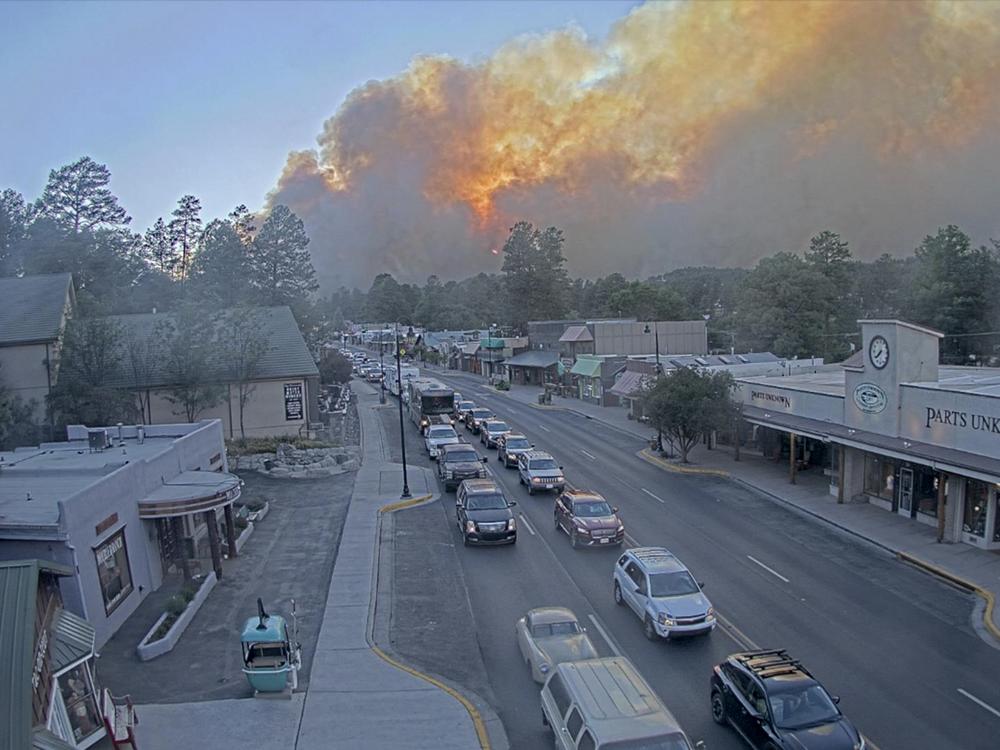
New Mexico Gov. Michelle Lujan Grisham declared a state of emergency early Tuesday for regions impacted by the Salt Fire and South Fork Fire, which alighted the previous day and have since burned more than 23,000 acres — a combined area larger than the size of Manhattan.
By Wednesday night, the fires were still zero percent contained. Officials said then that the blazes had damaged some 1,400 structures, including 500 believed to be homes.
And they confirmed that two people had been killed, a 60-year-old man found by the side of the road near a motel and another unidentified person in the driver’s seat of a burned vehicle — both in or near Ruidoso, the village between the two fires. Some 8,000 Ruidoso residents remain under evacuation orders.
Lujan Grisham called it “one of the most devastating fires in New Mexico history,” according to member station KUNM. She said that an additional 200 to 300 firefighters will be deployed to fight the South Fork Fire, the larger of the two, as it approaches higher-density living areas.
Thunderstorms on Wednesday night brought flash flooding, mudslides and a massive dust storm known as a haboob to parts of the state. Forecasters say thunderstorms will continue through Friday, though it’s unclear how much they will aid in quelling the fires.
Massive Haboob heading east to west across southern New Mexico. Reports of less than a 1/4 mile visibility SE of Deming. If traveling along I-10 west of Deming & I-25 north of Hatch, please use caution!!!! #nmwx pic.twitter.com/7vFJ6B1EQG
— NWS El Paso (@NWSElPaso) June 20, 2024
Crews are also battling several ongoing wildfires in Northern California, which have forced thousands of residents to evacuate.
Those include two fires that broke out Monday: the Aero Fire in Calaveras County (southwest of Sacramento), which is 52% contained as of Thursday morning and the Sites Fire in Colusa County (north of San Francisco), which is at 15 percent containment.
They have also made progress in containing the Post Fire in Los Angeles and Ventura County, which has scorched more than 15,000 acres since Saturday and is 47% contained as of Thursday, as well as Sonoma County’s Point Fire, which started Sunday and is 60% contained.
Member station KQED reports that climate experts are warning of a busy California wildfire season, especially in September and October when conditions are even drier.
The first storm of hurricane season arrived, and another could be on the way
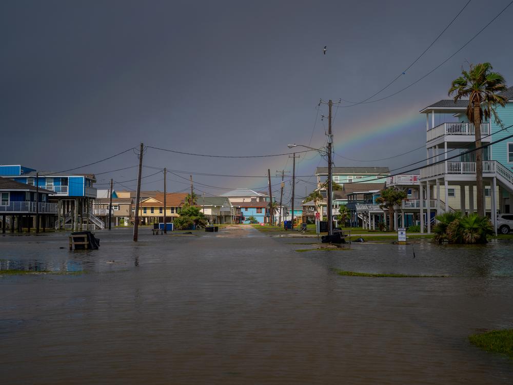
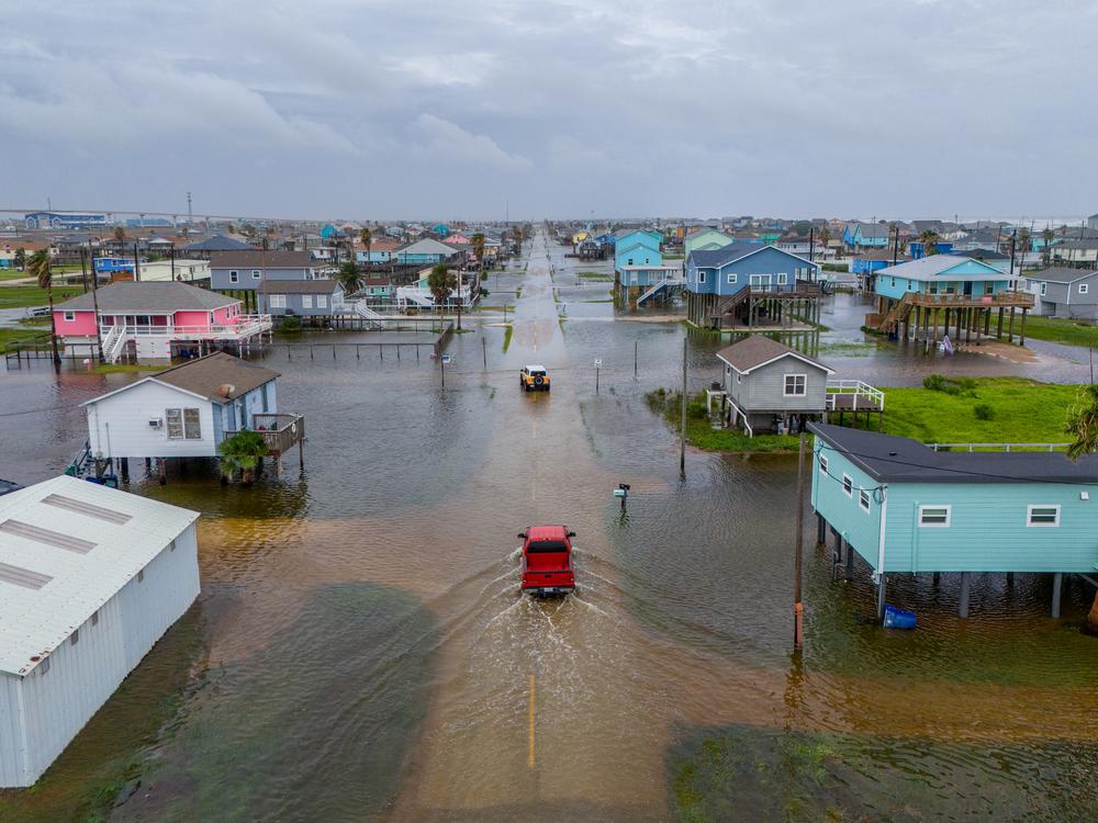
Alberto drenched coastal Texas as it made its way to Mexico on Wednesday, soaking numerous Deep South cities with between 2 and 5 inches of rain. It weakened to a tropical depression after making landfall in Mexico on Thursday morning.
Texas Gov. Greg Abbott declared a state of emergency for 51 communities to mobilize emergency response resources.
For example, it said the storm surge flooded the city of Surfside Beach, but that no injuries were reported. The city of Laredo quickly closed their emergency shelters because no one showed up.
In Mexico, however, Alberto was deadly. Authorities in the state of Nuevo León confirmed three deaths associated with the storm: a man died in a river in Monterrey, and two minors died from electric shocks in Allende.
As the rains and winds associated with Alberto taper off on Thursday, forecasters already have their eyes on the next possible storm brewing in the western Atlantic.
The National Hurricane Center tweeted that the area of low pressure could become a tropical depression before it reaches the coast of northeast Florida or Georgia on Friday.


