Caption
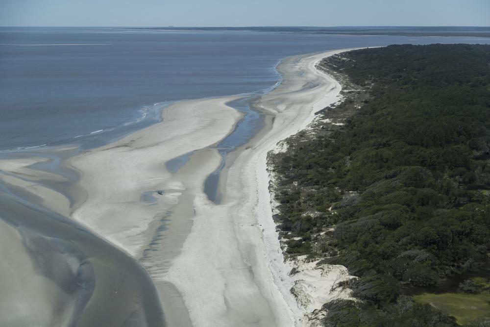
The mouth of Blackbeard Creek on Sapelo Island, as seen in 2017. The island's post office is among more than a dozen coastal infrastructure sites in Georgia identified in a new study on sea level rise.
Credit: Carol M. Highsmith Archive, Library of Congress