Section Branding
Header Content
Europe's intense rainfall in September twice as likely thanks to climate change
Primary Content
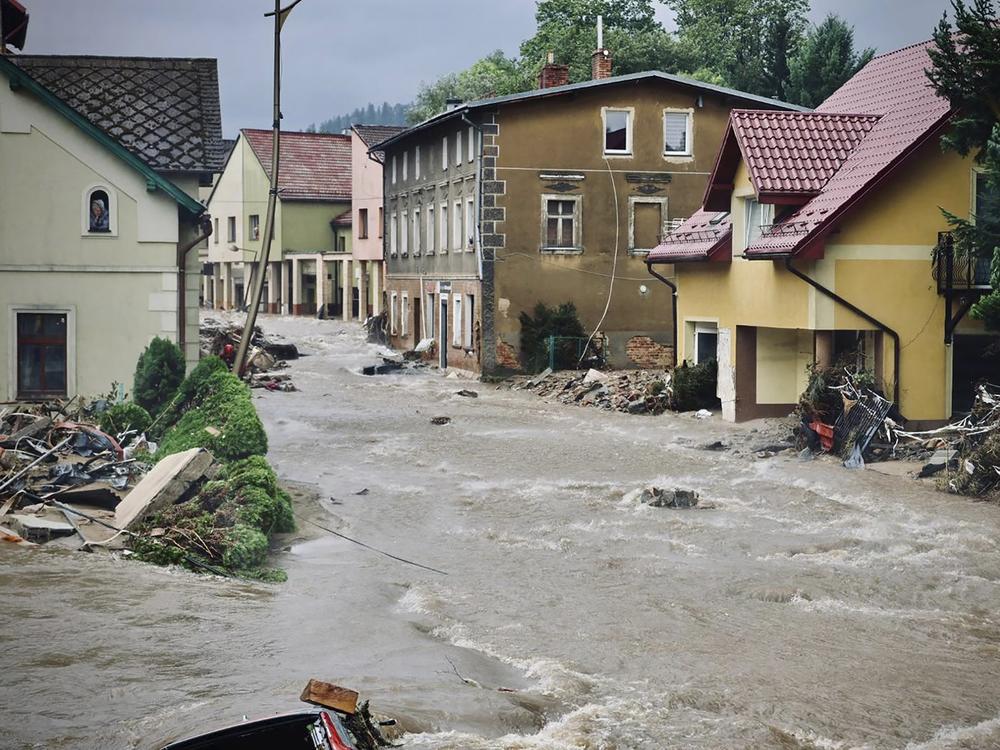
Massive rainfall inundated parts of Central and Eastern Europe in mid-September, dumping as much as two-thirds of some cities’ annual rain in just a few days.
The rainfall from the weather system, called Storm Boris, drove floods that claimed 24 lives. But early warnings from weather forecasters gave many cities time to prepare, and infrastructure improvements in others helped protect residents from the deluges, says Maja Vahlberg, a climate risk consultant with the Red Cross Red Crescent Climate Centre. It’s a sign, she says, that some parts of Europe, at least, are beginning to adapt to the more extreme weather brought on by human-caused climate change.
Vahlberg was an author of a new analysis published by the World Weather Attribution (WWA) group, an international association of climate scientists who quickly assess the impact of climate change on weather events. The new study shows that human-caused climate change roughly doubled the likelihood of the days-long intense rainfall in Central Europe. Climate change also intensified the deluge by at least 7%. The reinsurance company Gallagher Re estimates the flooding caused $2 billion to $3 billion in damages.
Friederike Otto, a climate scientist at Imperial College, London, and a lead of the WWA, warned that if Earth heats up to a full 2 degrees Celsius (3.6 Fahrenheit) above pre-industrial temperatures, “these events will become again 50% more likely,” and even more intense than this year’s storms. It’s a clear sign, she says, that “we need to prepare for even more heavy rainfall.”
Supercharged wet weather
The WWA team identified the storm system as a so-called “Vb” system (pronounced five-b), a weather pattern in which a low-pressure zone develops as cold air from the north flows over the high Alps and collides with warmer, wetter air coming from the south. And this system was big, sprawling over countries like Austria, Poland, and Romania.
Usually, weather systems move fairly quickly across the region, flowing along with the jet stream, moving west to east. This storm system got cut off from that normal flow—meaning it ended up stuck in place for days, with rain falling on ever-more saturated ground and into rivers and lakes that were already full.
The weather systems “stop moving, or they become very slow-moving, and they're able to sit in one place for a very long time,” says Hayley Fowler, a climate scientist at Newcastle University who was not involved in the research.
Climate scientists are still trying to figure out whether weather systems like this one are getting stuck in place more often. But there are hints that “these types of blocking situations and meandering jet stream-induced situations are increasing in frequency,” says Fowler. An analysis published earlier this week suggests further climate change will increase the likelihood and frequency of weather issues caused by weather patterns that stay in place—from dragged-out heat waves to longer rain events.
What’s more clear is that the storm system produced more rain than it would have if it happened 100 years ago, before fossil fuel burning kicked off in earnest, says Otto.
The reason the rainfall increased, she explains, is because of basic physics. Warmer air can hold more water, in the form of vapor: for each degree Celsius warmer the planet gets, the atmosphere can hold about 7% more water.
So there is simply more water available to turn into rain during a weather event like this, says Andreas Prein, a climate scientist at ETH Zurich, who was not involved in the WWA research.
“This is the one thing that we're most certain about,” Prein says. “Temperature is increasing. The atmosphere can hold more moisture because it's warmer. And then you can have more extreme rainfall.”
When the storm system was developing, he found himself looking at temperature records from the Mediterranean Sea and the Black Sea, where some of the air masses feeding the storm were coming from. Both seas were unusually hot.
Fowler saw the same thing. “The double whammy in this case was really the fact that the Mediterranean Sea is so warm this year,” she says. “And obviously, that's also an effect from climate change.”
The Mediterranean Sea was some 3 degrees Celsius (5.4 degrees Fahrenheit) warmer than the long-term average this summer.
Steps toward resiliency
Twenty-four people died in the September floods. Overall, that’s a much smaller number than during previous flood events like the deluge in Western Europe in 2021, which killed more than 200 people, or a 2002 event in a similar part of the world, which took 232 lives.
That signals that preparations countries have taken are working. “The 2024 floods were well forecast in early warning systems,” says Vahlberg of the Red Cross. That “allowed for timely evacuations and pre-emptive water releases in many areas, which did help keep the death toll significantly lower compared to the similar events in 1997 and 2002,” she says.
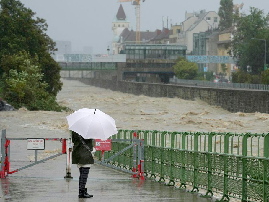
Cities like Vienna, which had experienced devastating flooding during previous storms, have poured millions of dollars into upgrading their flood management infrastructure. The investments paid off, says Fowler: the city experienced only minor flooding, compared to city-wide evacuations that had to happen elsewhere.
But further climate change will fuel even more intense storms, leading to even more stress on infrastructure, warning systems, and communities, Vahlberg says. It’s clear, she says, that “future proofing our cities demands continuous adaptation to outpace these evolving threats.”


