Caption
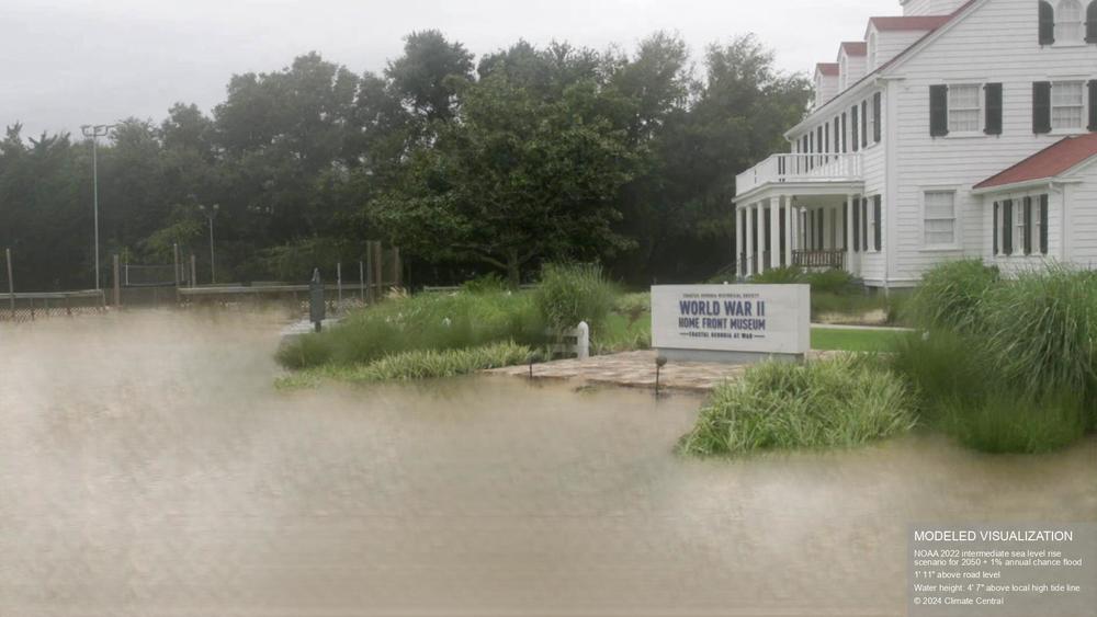
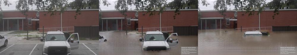
A FloodVision rendering of a 1% annual chance flood in 2050 at the World War II Home Front Museum on St. Simons Island.
Credit: Climate Central FloodVision®
LISTEN: Climate Central's FloodVision combines street-level photographs with future sea-level rise and flood risk projections. GPB's Benjamin Payne reports.
A climate science nonprofit is deploying a new tool to help show what major flooding might look like across the East Coast, including Coastal Georgia, as climate change worsens sea-level rise and intensifies storms.
Climate Central recently outfitted a Ford F-150 Lightning electric pickup truck with stereoscopic cameras, incorporating the images with GPS data and LiDAR remote sensing to determine the approximate height of every pixel captured.
The images were then processed by generative AI to illustrate flood visualizations, informed by NOAA projections of sea-level rise in 2050 and 2100 and by peer-reviewed scientific publications.
“We think that if you can see into the future, maybe we can change the future and shape the future,” said Climate Central researcher Allison Kopicki, who described the tool as “Google Street View, but for coastal flooding.”
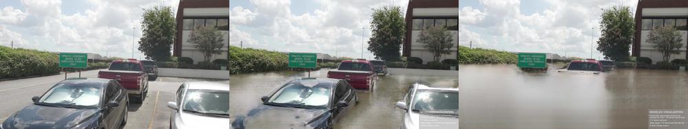
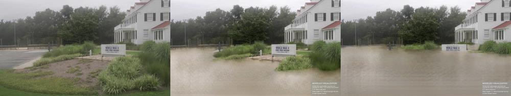
Below are five locations in Coastal Georgia that were rendered by FloodVision under dry conditions, a 1% annual chance flood in 2050 and a 1% annual chance flood in 2100.
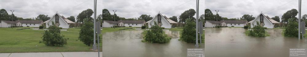
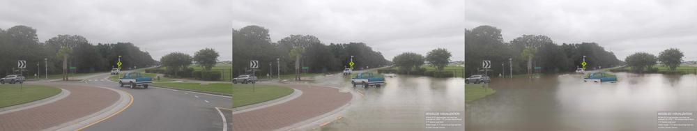
Climate Central cautioned that FloodVision could underestimate actual flooding because storms may become stronger and more frequent than projected and because its modeling does not account for rainfall, inland flooding and river flooding.
The group also cautioned that its tool could overestimate flooding since it does not account for coastal defenses such as levees and since it utilizes a “bathtub model” that assumes uniform water levels across the landscape.