Section Branding
Header Content
A 'bomb cyclone' is expected to hit Pacific Northwest. Here is what you should know
Primary Content
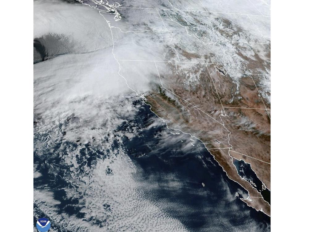
A powerful storm system known as a "bomb cyclone" is expected to hit northwestern states and the Pacific coast in the next few days, causing dangerous conditions, weather forecasters say.
A low-pressure system out of the Pacific is expected to produce "significant high wind impacts and heavy mountain snow" across parts of Washington state, Oregon and Idaho, according to the National Weather Service (NWS).
"A strong atmospheric river" storm will also hit northern California by Wednesday. Rainfall and flooding that is "life threatening" is also expected along the northwest coast late Tuesday through the rest of the week.
The worst part of the storm will occur Wednesday through Friday as parts of the northern California coast are at high risk of excessive rainfall, with areas receiving 10-15 inches in a 48-hour period.
"Heavy rain and rising snow levels will increase the threat of numerous floods and potential mudslides, exacerbated by the duration of heavy rainfall through the end of the week," the NWS Weather Prediction Center said Tuesday.
Parts of the region will also receive heavy and wet snow, with mountain areas in the northwest seeing 2-3 inches of snow accumulate per hour Wednesday and Thursday, with several feet of snow at high elevations.
There will also be whiteout conditions with 65-mph wind gusts that will lead to "near impossible travel, especially at pass level in the Cascades and Northern California," the NWS also warns.
Expected wind gusts topping 60 mph will also lead to downed trees and power outages as well as a "potentially damaging" high surf that will impact the coastline. Blizzard and high wind warnings are also in effect for portions of Washington, including the Seattle area.
What is a bomb cyclone?
A "bombogenesis" or what is commonly known as a "bomb cyclone," is a midlatitude (between the tropics and polar regions) cyclone that rapidly intensifies over a 24-hour period and when atmospheric pressure drops significantly, by at least 24 millibars, according to the National Ocean Service. This occurs when cold and warm air masses collide.
The pressure in the storm system impacting the Pacific Northwest is expected to continue to drop, Brian Hurley, senior meteorologist at the NWS Weather Prediction Center, told NPR on Tuesday.
"This morning, it was at 981 millibars. And by the time we get to this evening ... it looks like it could be 946 millibars," Hurley said. "That's 35 millibars in 12 hours, and that definitely meets the criteria of 24 millibars in 24 hours in terms of the pressure drop."
Take precautions now
The NWS Seattle office on Monday urged residents to "take precautions now to ensure you and your family stay safe" ahead of the incoming strong winds, including checking emergency kits, repairing shutters and trimming trees. The agency also noted that the safest place is "inside, in an interior room, and away from windows."
The Oregon State Fire Marshal on Monday advised residents to "stay safe," charge their electronic devices and if power is lost, to use a flashlight instead of candles and to avoid using generators indoors.
California's emergency services office also cautioned residents to be prepared and "make an emergency plan and sign up for emergency alerts."

