Section Branding
Header Content
An Arctic outbreak will send a chill through much of the U.S. Here's how to prepare
Primary Content
The new year is bringing a cold front with it, as multiple blasts of Arctic air are poised to hit much of the United States in the first half of January.
"As we round out 2024 and head into 2025, above normal warmth across the eastern half of the U.S. will be quickly replaced by a series of Arctic outbreaks... with the coldest air of the season set to take hold through next week," the National Weather Service (NWS) said on X on New Year's Eve.
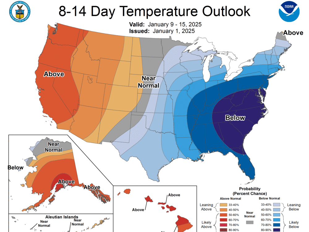
It predicts an Arctic outbreak will spread from the Northern Plains to the south and east in the days ahead, leading to "exceptionally high probabilities of below-normal temperatures" across the eastern part of the country into next week.
Below-freezing temperatures are possible as far south as Florida and the Gulf Coast, the NWS says.
The NWS defines Arctic outbreaks as "very cold air masses that typically originate in the Siberian Region of Asia, cross over the north pole into Canada and push south and east into the lower United States." They occur regularly but push this far down into the southern U.S. only every four to five years; an Arctic outbreak in January 2019 was linked to nearly two dozen deaths and thousands of disrupted flights.
Frigid temperatures already arrived in the northern Plains midweek and are expected to spread south and east through the end of the weekend. Another more extreme Arctic outbreak is forecast to bring even colder temperatures to the same areas next week.
Temperatures will be 5 to 20 degrees colder than usual for a large swath of the country, CNN reports.
It says high temperatures could be near the freezing mark in places like St. Louis and Cincinnati, while single-digit lows are expected in Nebraska, Iowa and Illinois. In northern North Dakota, lows could reach 25 degrees below zero. Even Orlando, Fla., where highs are typically in the low 70s this time of year, could see those highs drop to the mid-50s.
But the question of exactly how cold it will get — and where — remains somewhat up in the air.
Forecasters say there's a chance the cold spell could bring with it a lobe of the polar vortex, the strong band of westerly winds that forms above the North Pole every winter and contains a large pool of extremely cold air. The polar vortex was a key factor in the February 2021 cold spell that brought record lows to Texas — and broke its electric grid.
The latest long-term outlook from the NWS Climate Prediction Center suggests the cold spells could last through at least Jan. 15. All told, the Arctic air could affect more than 250 million people across 40 states, according to AccuWeather.
A weekend storm could add snow and ice to the mix
Areas from the central Plains to mid-Atlantic could also see heavy snow and hazardous ice, as forecasters warn of a winter storm moving east over the weekend.
Forecasters say it could impact infrastructure and disrupt travel, especially in harder-hit areas across the Appalachians, Ohio Valley, interior mid-Atlantic, Great Lakes and interior Northeast.
There's a high chance that areas in the central Plains and Mississippi Valley will see up to 6 inches of snow, according to the NWS.
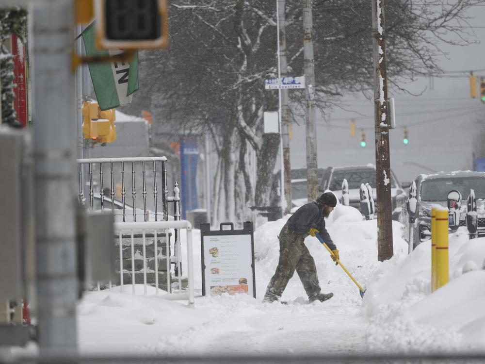
Parts of upstate New York and Pennsylvania are under lake-effect warnings through Sunday night, with New York Gov. Kathy Hochul warning that certain counties could see up to 3 feet of snow.
"Heavy Lake Effect snow is likely to enhance totals for areas downwind of the Great Lakes as the Arctic Air pushes south across partially unfrozen waters," the NWS explains.
Heavy snow could in turn make temperatures feel even colder, since fallen snow both absorbs and reflects the sun's rays.
The NWS is also warning of "potentially significant" sleet and rain this weekend in areas farther south: eastern Kansas and the Ozarks, as well as the Tennessee and lower Ohio valleys. It says the southern Appalachians could also see icing on Sunday.
How to prepare for a cold snap
The NWS is advising people to prepare themselves and their homes for the cold before it arrives.
It recommends stocking up on enough nonperishable food, water and medications to last for three days; updating your first-aid kit; gathering up your warmest clothing and blankets; keeping your phone charged; and checking for Wireless Emergency Alerts.
People should minimize time outdoors for both themselves and their pets and also take precautions when they do go outside.
Once inside, people should insulate their pipes if possible, open sink cabinets to expose pipes to heated air and disconnect their hoses and sprinklers to prevent pipes from freezing and bursting.
The NWS also encourages people to check in on loved ones and neighbors, especially if they are in groups considered vulnerable: newborns, older adults, outdoor workers, people with chronic illness and people without homes.
Here are even more tips from NPR on prepping your car for winter driving, weathering power outages and protecting your home before and after a winter storm.


