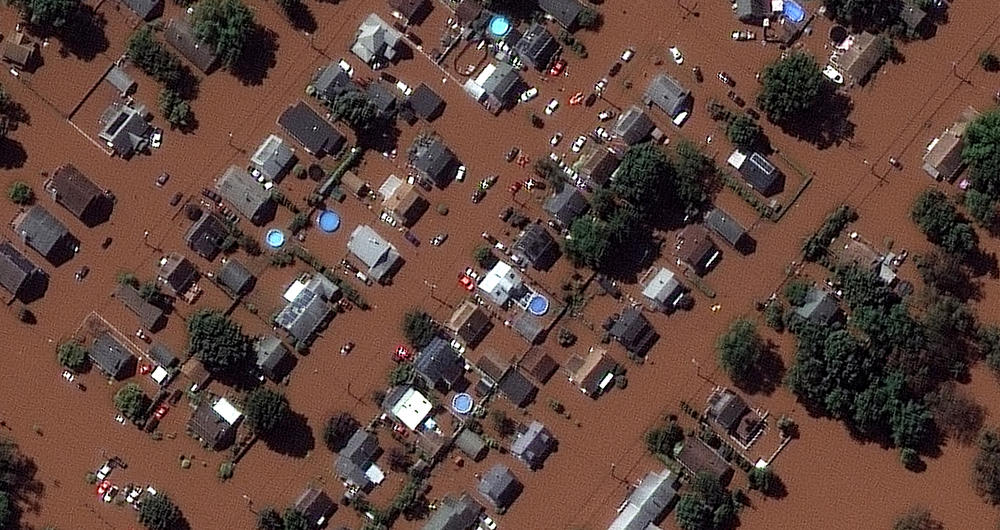
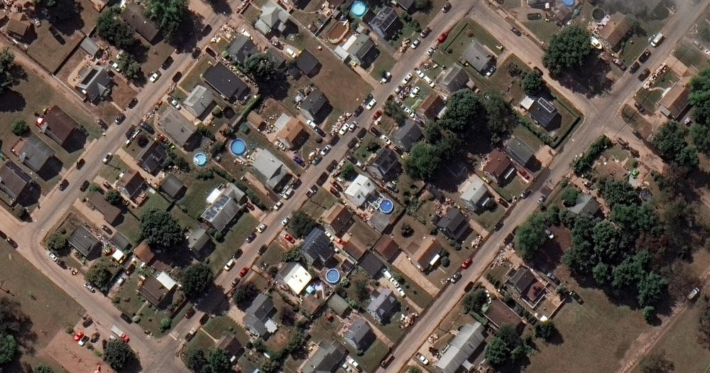
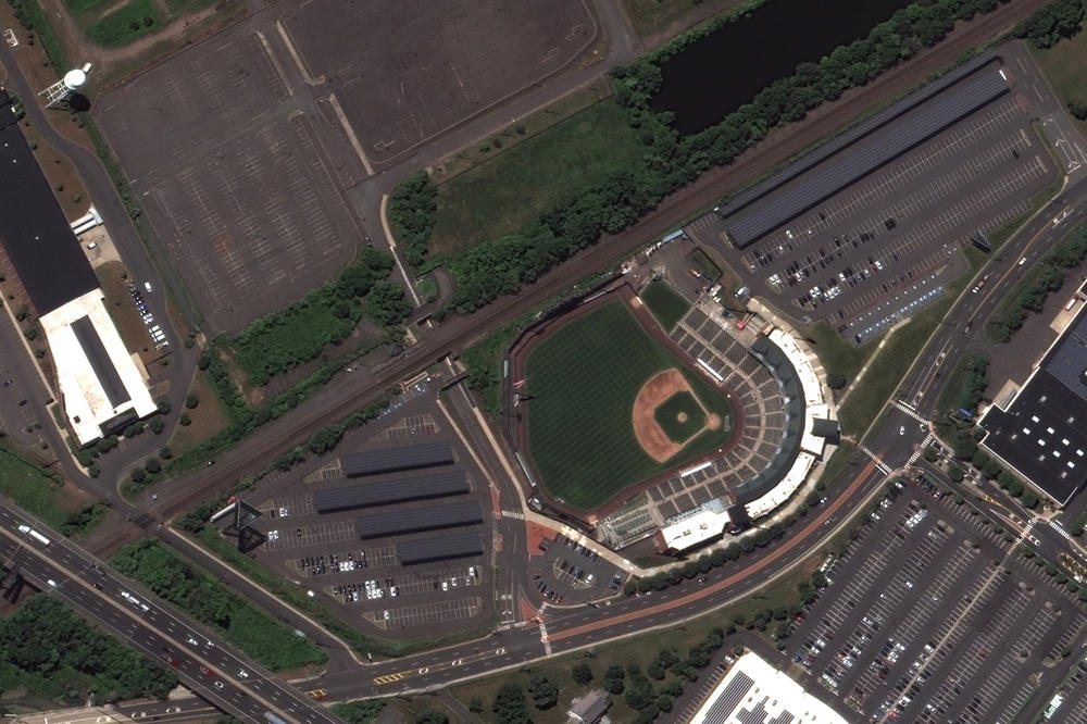
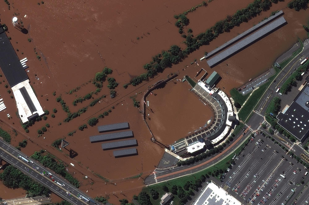
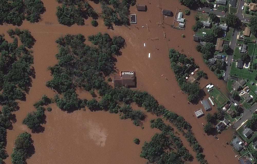
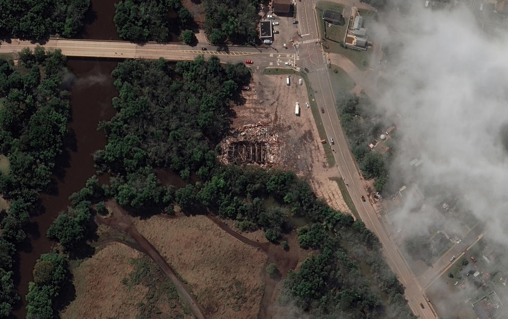
When the remnants of Hurricane Ida swept through New Jersey last week, the devastation left behind was unlike anything most residents had ever seen.

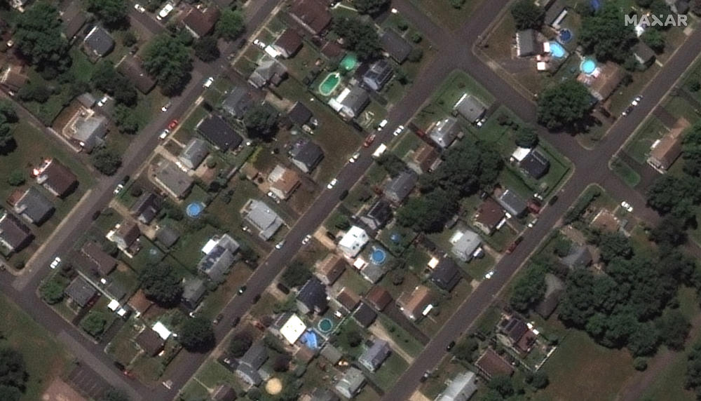
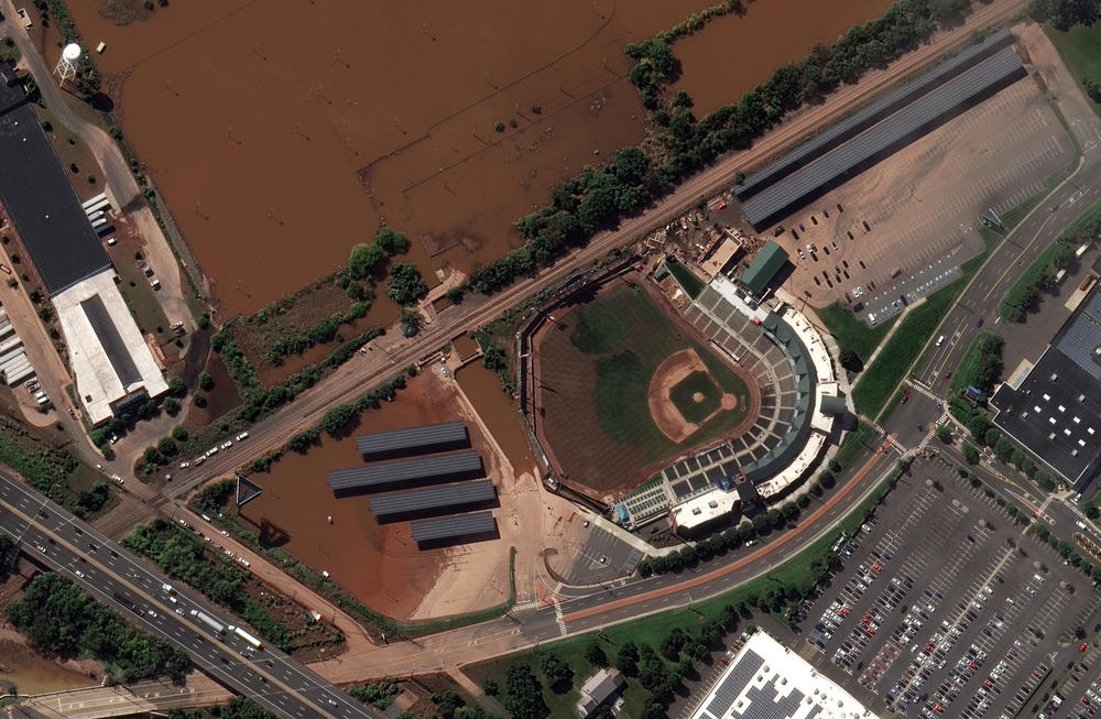
Satellite photos taken over the state show how record-breaking rainfall led to stunning levels of flooding along the Raritan River — flooding that submerged neighborhoods, roads and parking lots throughout much of the region.

<strong>DURING FLOOD - Sept. 2, 2021:</strong> Overview of flooded homes along Huff Avenue and Railyard in Manville, N.J.
Caption

DURING FLOOD - Sept. 2, 2021: Overview of flooded homes along Huff Avenue and Railyard in Manville, N.J. / Satellite image ©2021 Maxar Technologies

<strong>BEFORE FLOOD - July 14, 2020</strong>: Overview of homes along Huff Avenue and Railyard in Manville, N.J.
Caption

BEFORE FLOOD - July 14, 2020: Overview of homes along Huff Avenue and Railyard in Manville, N.J. / Satellite image ©2021 Maxar Technologies

<strong>AFTER FLOOD - Sept. 4, 2021</strong>: Overview of homes along Huff Avenue and Railyard in Manville, N.J.
Caption

AFTER FLOOD - Sept. 4, 2021: Overview of homes along Huff Avenue and Railyard in Manville, N.J. / Satellite image ©2021 Maxar Technologies

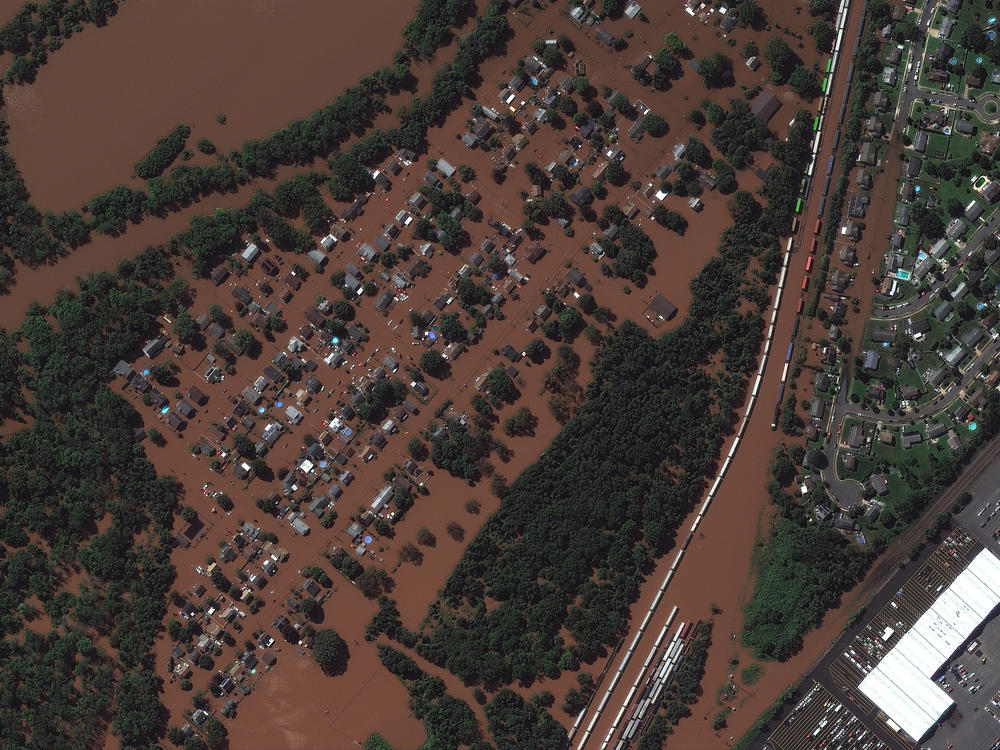
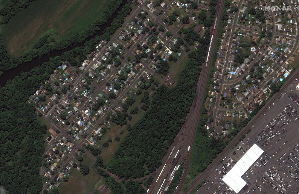
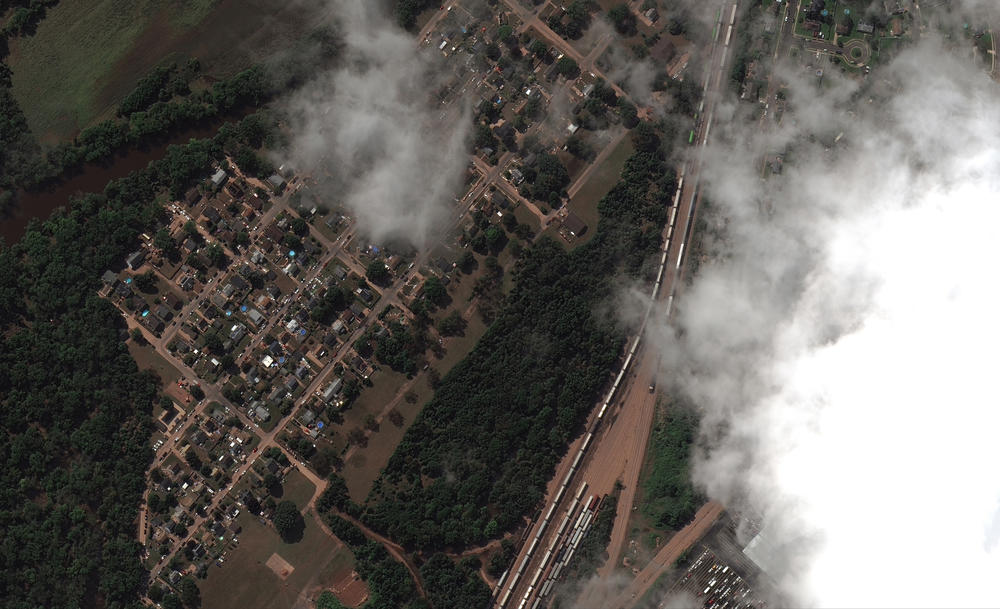
Multiple towns in the state are experiencing extreme damage from the flooding, including Manville, New Brunswick, Somerville, South Bound Brook.

At least 25 people have died in New Jersey from the unprecedented floods and six people were reported missing, Gov. Phil Murphy said Friday. There were also deaths in nearby New York and Connecticut.

The images of flooding and the subsequent damage seen here were taken by Maxar Technologies on Sept. 2. and Sept. 4.

Copyright 2021 NPR. To see more, visit https://www.npr.org.

<strong>BEFORE FLOOD - July 14, 2020:</strong> Close-up of homes along Boesel Avenue in Manville, N.J.
Caption

BEFORE FLOOD - July 14, 2020: Close-up of homes along Boesel Avenue in Manville, N.J. / Satellite image ©2021 Maxar Technologies

<strong>DURING FLOOD - Sept. 2, 2021:</strong> Closeup of homes flooded along Boesel Avenue in Manville, N.J.
Caption

DURING FLOOD - Sept. 2, 2021: Closeup of homes flooded along Boesel Avenue in Manville, N.J. / Satellite image ©2021 Maxar Technologies

<strong>AFTER FLOOD - Sept. 4, 2021:</strong> Closeup of cleanup of homes along Boesel Avenue in Manville, N.J.
Caption

AFTER FLOOD - Sept. 4, 2021: Closeup of cleanup of homes along Boesel Avenue in Manville, N.J. / Satellite image ©2021 Maxar Technologies

<strong>BEFORE FLOOD - July 14, 2020</strong>: TD Bank Ballpark in Bridgewater, N.J.
Caption

BEFORE FLOOD - July 14, 2020: TD Bank Ballpark in Bridgewater, N.J. / Satellite image ©2021 Maxar Technologies

<strong>DURING FLOOD - Sept. 2, 2021:</strong> TD Bank Ballpark in Bridgewater, N.J.
Caption

DURING FLOOD - Sept. 2, 2021: TD Bank Ballpark in Bridgewater, N.J. / Satellite image ©2021 Maxar Technologies

<strong>AFTER FLOOD - Sept. 4, 2021:</strong> TD Bank Ballpark in Bridgewater, N.J.
Caption

AFTER FLOOD - Sept. 4, 2021: TD Bank Ballpark in Bridgewater, N.J. / Satellite image ©2021 Maxar Technologies

<strong>DURING FLOOD - Sept. 2, 2021: </strong>View of Saffron Banquet Hall in Manville, N.J.
Caption

DURING FLOOD - Sept. 2, 2021: View of Saffron Banquet Hall in Manville, N.J. / Satellite image ©2021 Maxar Technologies

<strong>AFTER FLOOD - Sept. 4, 2021:</strong> View of destroyed Saffron Banquet Hall in Manville, N.J.
Caption

AFTER FLOOD - Sept. 4, 2021: View of destroyed Saffron Banquet Hall in Manville, N.J. / Satellite image ©2021 Maxar Technologies