Section Branding
Header Content
Tropical Storm Debby is flooding the Southeast, and it’s barely moving
Primary Content
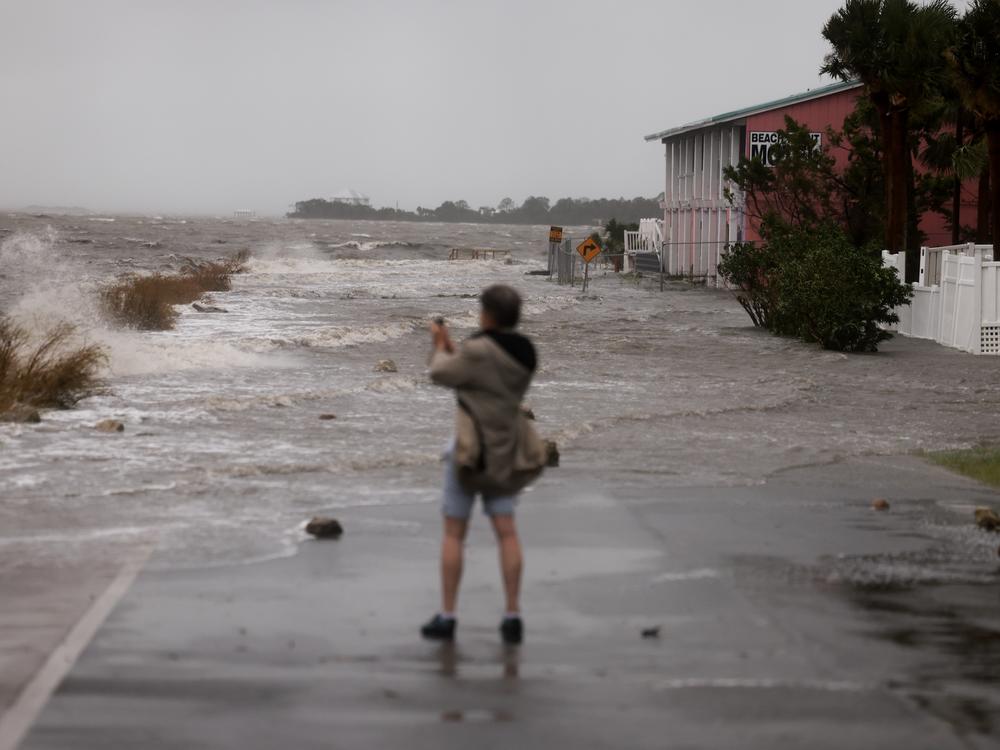
Tropical Storm Debby is creeping over land with winds that would never make headlines. But the storm’s slow movement is adding to the devastating impact of its heavy rains, as it inundates already-soaked areas of Georgia, South Carolina and Florida.
With the storm predicted to meander along the coast, this week’s rainfall could be "historic" — measured in feet, not inches, in some areas, according to forecasts.
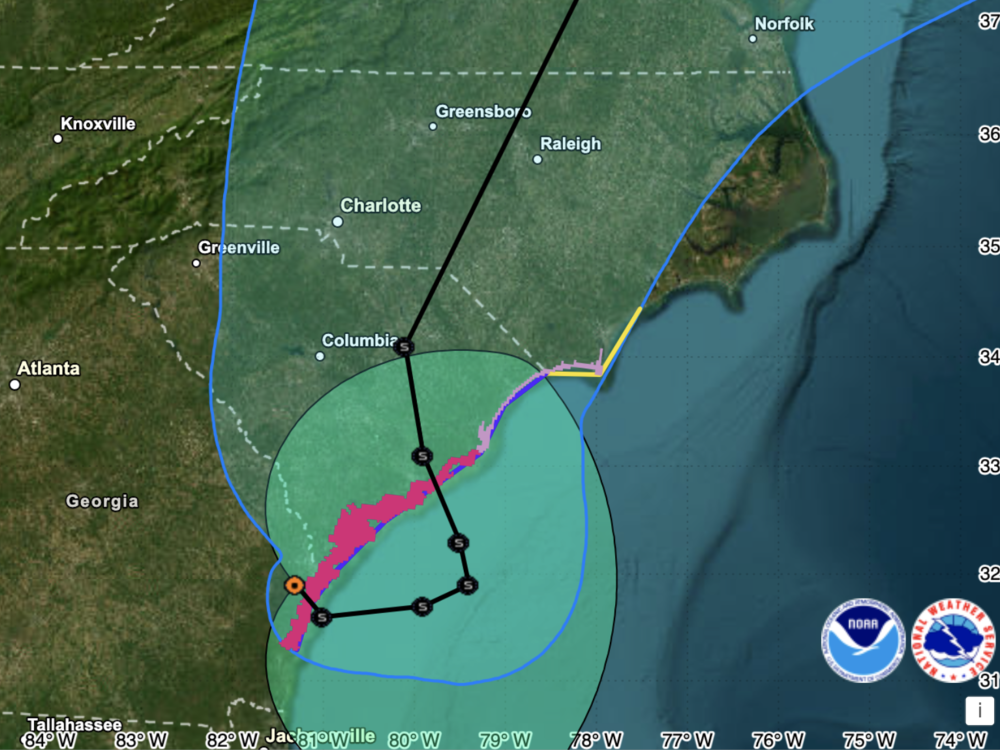
Debby was creeping along at 6 mph as of 11 a.m. ET Tuesday morning, with its center located about 15 miles south of Savannah, Ga., the National Hurricane Center said. It’s expected to move east and cross over Georgia's coast and into the Atlantic Ocean later Tuesday, where it will begin an unusual zig-zag motion, eventually veering westward toward the South Carolina coast.
The storm “is expected to produce potentially historic rainfall totals of 10 to 20 inches, with maximum amounts of 25 inches” in parts of Georgia, South Carolina and North Carolina, the NHC said on Tuesday, warning of the threat of “catastrophic flooding.”
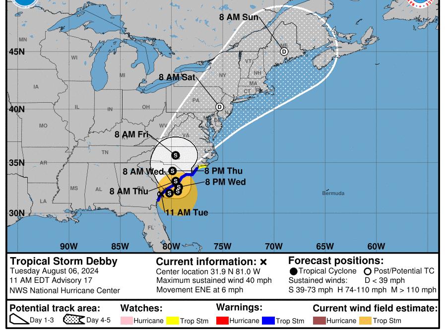
Debby's forward progress will be painfully slow. The NHC says its center will reach the South Carolina shore around midday Thursday. It will remain in the state into Friday, before regaining momentum.
More than 14 inches of rain has already fallen in the inland South Carolina community of Green Pond, with nearby Edisto Beach seeing nearly 12 and a half inches since 8 a.m. Saturday, according to the latest rainfall totals.
Lakewood Ranch, Fla., northeast of Sarasota, recorded 17.6 inches of rain — one of several places that saw more than a foot of rainfall.
As Debby moves on, parts of Florida stand to receive a few more inches of rain. Farther north, the mid-Atlantic and New England could also see flooding through Sunday morning.
As of Tuesday, the storm’s predicted track takes it back ashore just north of Charleston on a north-northwest path. After nearing the middle of South Carolina, Debby is expected to veer to the north-northeast, moving toward Raleigh and Durham, N.C.
Debby will regain strength and intensity over the Atlantic, powered by very warm waters of more than 84 degrees Fahrenheit. But it’s not expected to regain hurricane status before making landfall again.
The NHC forecasts a storm surge to range between 2 to 4 feet in a broad area from Altamaha Sound, Ga., to Cape Fear, N.C.
Nearly 2 million people also face the threat of tornadoes: Early Tuesday, the National Weather Service issued a tornado watch for a region stretching from below Charleston to above Wilmington, N.C., lasting until 5 p.m. ET.
Debby made landfall early Monday as a category 1 hurricane, touching down on Florida's Big Bend coastline about 5 miles west of the community of Steinhatchee.
The frequency of intense and destructive tropical storms and hurricanes has been linked to climate change. As NOAA has stated, “Warming of the surface ocean from human-induced climate change is likely fueling more powerful tropical cyclones.”
The storms’ destructive power is then magnified by other factors related to global warming, from rising sea levels to more intense rainfall totals.
Bottom Content
