Section Branding
Header Content
Hurricane Francine is predicted to make landfall west of New Orleans
Primary Content
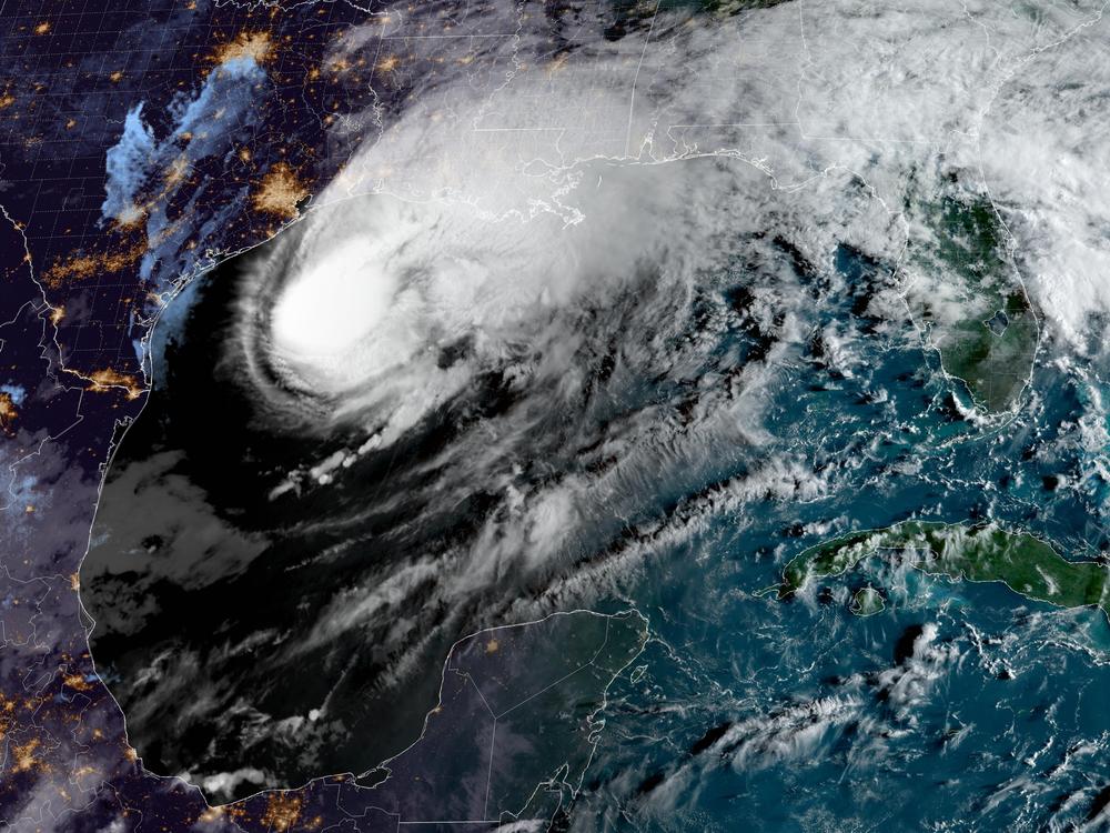
Hurricane Francine is crossing over warm waters in the western Gulf of Mexico, and it has Louisiana’s coast — and the greater New Orleans area — in its sights, according to the National Hurricane Center’s latest forecast.
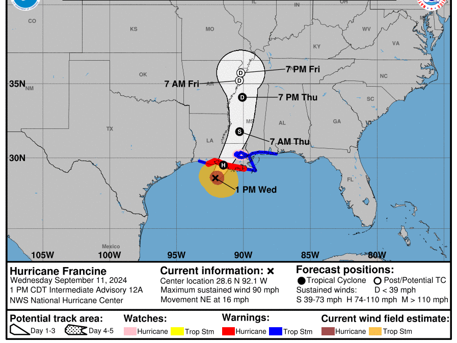
The storm became a hurricane Tuesday night; its maximum sustained winds are roughly 90 mph, with higher gusts. As of 1 p.m. CT, Francine was about 95 miles southwest of Morgan City, La., moving northeast at 16 mph.
“Francine is anticipated to make landfall in Louisiana … late this afternoon or evening,” the hurricane center said on Wednesday.
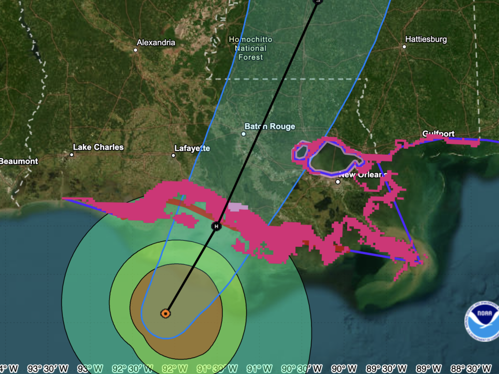
If the storm surge coincides with high tide, water could reach 5 to 10 feet above ground in areas from Louisiana's Intracoastal City and Vermilion Bay to Port Fourchon.
The hurricane's outer bands of rain began hitting Lafayette, Baton Rouge and other areas in southern Louisiana Wednesday morning. In the gulf, an oil platform north of the storm's center reported a peak gust of 105 mph, the NHC said.
Evacuations, and New Orleans under a hurricane watch
Parishes along the coast issued mandatory or voluntary evacuations this week, warning of flooding, high winds and other effects of the storm. On Tuesday, Iberia Parish also declared a curfew starting at 11 a.m. CT Wednesday and running through 7 a.m. Thursday.
A hurricane warning — meaning hurricane conditions are expected in the area — is in effect for a swath of Louisiana's coast from the line separating Vermilion and Cameron parishes eastward to Grand Isle, south of New Orleans.
The metropolitan New Orleans area is under a hurricane watch, meaning hurricane conditions are possible within 24 hours. Rainfall could range from 4 to 12 inches along the coasts of Louisiana, Mississippi and Alabama — which are also under storm surge alerts.
“The deepest water will occur along the immediate coast near and to the east of the landfall location, where the surge will be accompanied by large and dangerous waves,” according to the NHC.
“Make sure you have all preparations rushed to completion ASAP!” the National Weather Service office in New Orleans said. “Then, prepare to hunker down & shelter in place through the overnight hours!”
For anyone in the storm’s path, member station WWNO has ongoing coverage and a guide to help preparing for the hurricane.
Forecast includes some welcome tidbits
While the hurricane’s risks and dangers are substantial, there are bits of welcome news in the forecast. First of all, it's not expected to strengthen very much before reaching the shore. And as it nears land, conditions are expected to “cause drier air to wrap around the southern portion of Francine as it nears the coast. Thus, the hurricane is not expected to continue strengthening through landfall,” the hurricane center said.
Forecasters also believe the hurricane’s floodwaters will not pose a threat to a system of levees meant to reduce risk of damage from hurricanes and storms in Louisiana, although rising water levels could reach the top of some local levees.
While some storms have inflicted their worst damage by lingering for days, dropping torrential rains, Francine is expected to rapidly weaken and move into Mississippi by Thursday. But forecasters also warn against complacency, citing the storm’s power and the potential for dangerous flash and urban flooding.
“We need to keep our eyes on this one. It won’t be Laura, it won’t be Ida, but it is still going to be an extensive impact in terms of the role of that storm as it rolls into south-central and southeastern Louisiana," state climatologist Jay Grymes said.
President Biden declared an emergency in Louisiana on Tuesday, granting a request from Gov. Jeff Landry that will speed the flow of aid and resources to the state.


