Section Branding
Header Content
This Week In Georgia Weather
Primary Content

An active weather pattern prevails this week as upper-level-low pressure systems spin out from the jet stream. It will seem that we will be dry, then wet, then wet some more, then dry for a day, and then wet again throughout the period. We'll start off warm and in the 60's/70's during the first half of the week, but cold temperatures will return during the early hours on Friday. All images courtesy of Wright-Weather.com
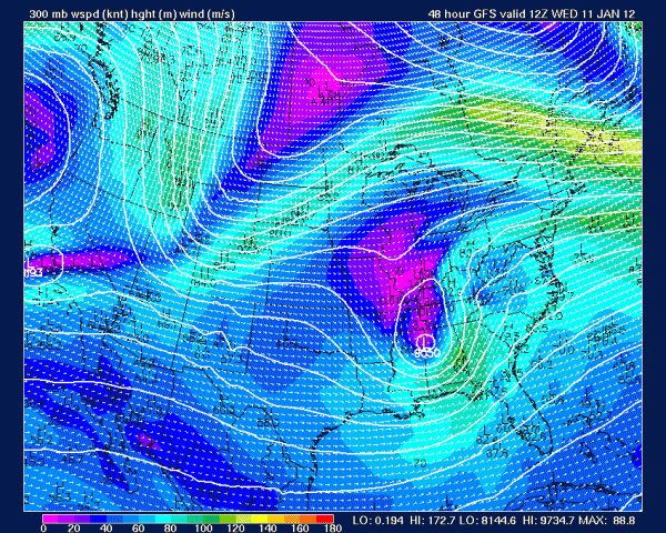
300mbar Level for 7am Wednesday, January 11th.
Note the upper level low west of Georgia.
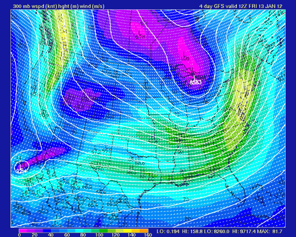
300mbar Level for 7am Friday, January 13th.
Georgia is still influenced by a longwave trough.
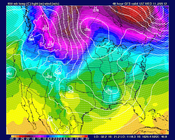
850mbar Level for 7am Wednesday, January 11th. A pocket of cold air is
associated with the low west of the state.
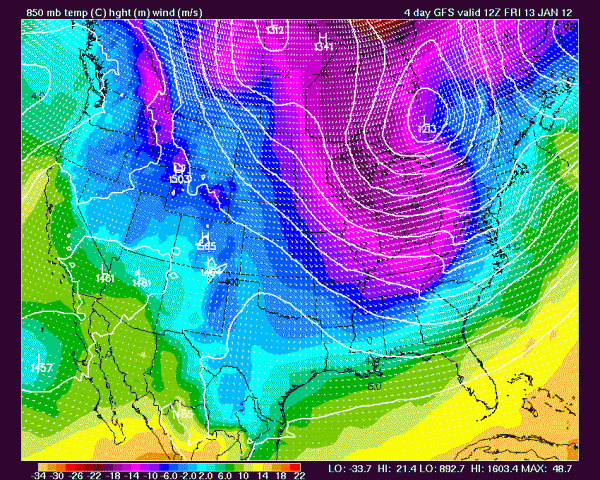
850mbar Level for 7am Friday, January 13th. Cold air infiltrates the state.

Surface map for 7am Wednesday. Rain is expected for most of the state,
with some areas picking up nearly an inch and a half of precipitation.
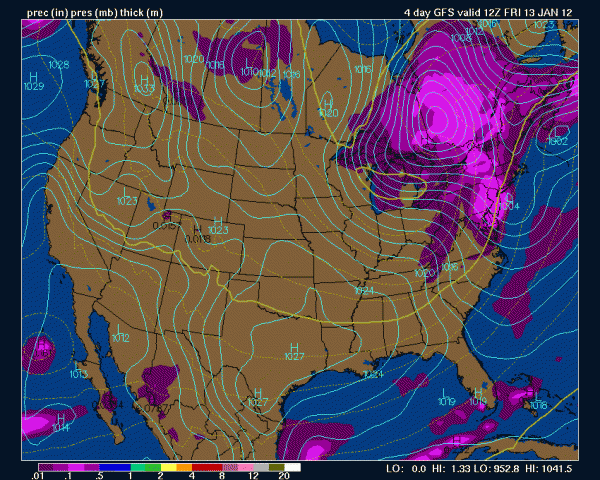
Surface map for 7am Friday. Dry yet breezy conditions prevail.
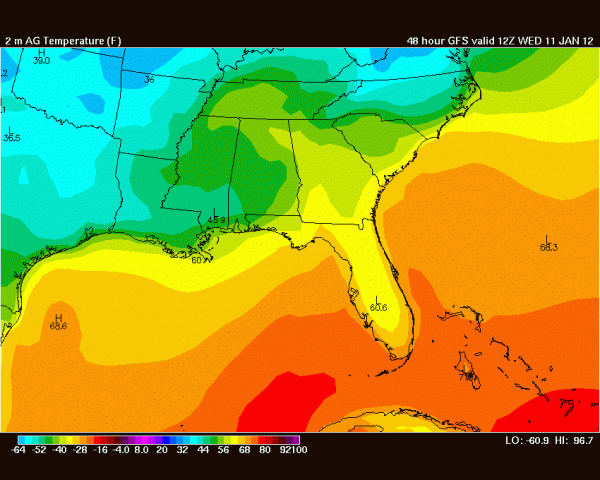
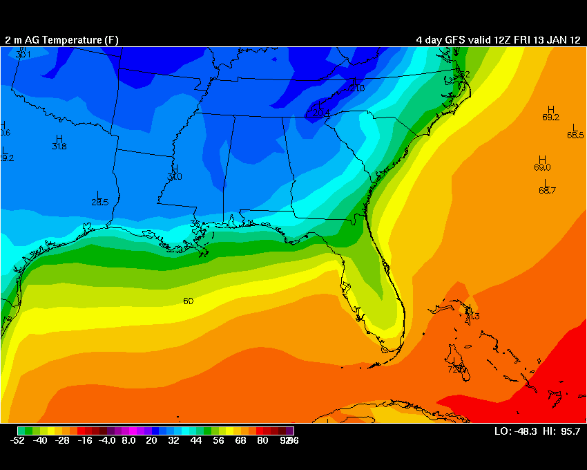
Surface temperature forecast for 7am Wednesday.
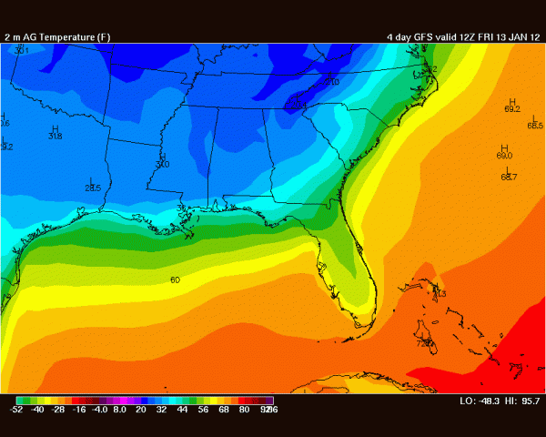
Surface temperature forecast for 7am Friday. Cold conditions return,
with many cities plunging into the 30's.
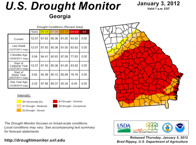
The Georgia Drought monitor for the week of January 3, 2012.


