Section Branding
Header Content
A key route in Death Valley buried in floods will be closed for another week
Primary Content
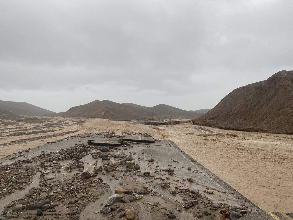
DEATH VALLEY NATIONAL PARK, Calif. — A main roadway into Death Valley National Park will remain closed into next week as crews clean up after record-breaking rains damaged the roadway and choked it with mud, rocks and debris.
Flash flooding in the park last week trapped hundreds of hotel guests and partially buried about 60 cars and trucks in mud. No injuries were reported.
The California Department of Transportation said about 30 miles (48 kilometers) of State Route 190 were partially or fully buried with debris and about 20 miles (32 kilometers) have been cleared.
However, the route will remain closed at least through Aug. 17 from Trona Wildrose Road/Panamint Valley Road to State Route 127 in Death Valley Junction, Caltrans said in a statement.
"As our crews continue to remove debris. They have found several damaged sections of highway with complete shoulder loss, damage to asphalt, and undercutting of the roadway," Caltrans District 9 Director Ryan Dermody said.
Some of the debris collected will be used to fill in eroded road shoulders, Caltrans said.
On Monday, flash flooding from a monsoonal moisture system also closed a 5-mile (8-kilometer) stretch of road and prompted the evacuation of the southern portion of Joshua Tree National Park, another desert park about a 4-hour drive south of Death Valley.
No injuries were reported.
Death Valley National Park, located near the California-Nevada state line, has over 1,000 miles (1,609 kilometers) of roadway across 3.4 million acres (1.3 million hectares).
The record-breaking rains last Friday dumped 1.46 inches (3.71 centimeters) of rain at the Furnace Creek area. That's about 75% of what the area typically gets in a year, and it is more than has ever been recorded for the entire month of August.
Since 1936, the only single day with more rain was April 15, 1988, when 1.47 inches (3.73 centimeters) fell, park officials said.
Copyright 2022 NPR. To see more, visit https://www.npr.org.

