Caption
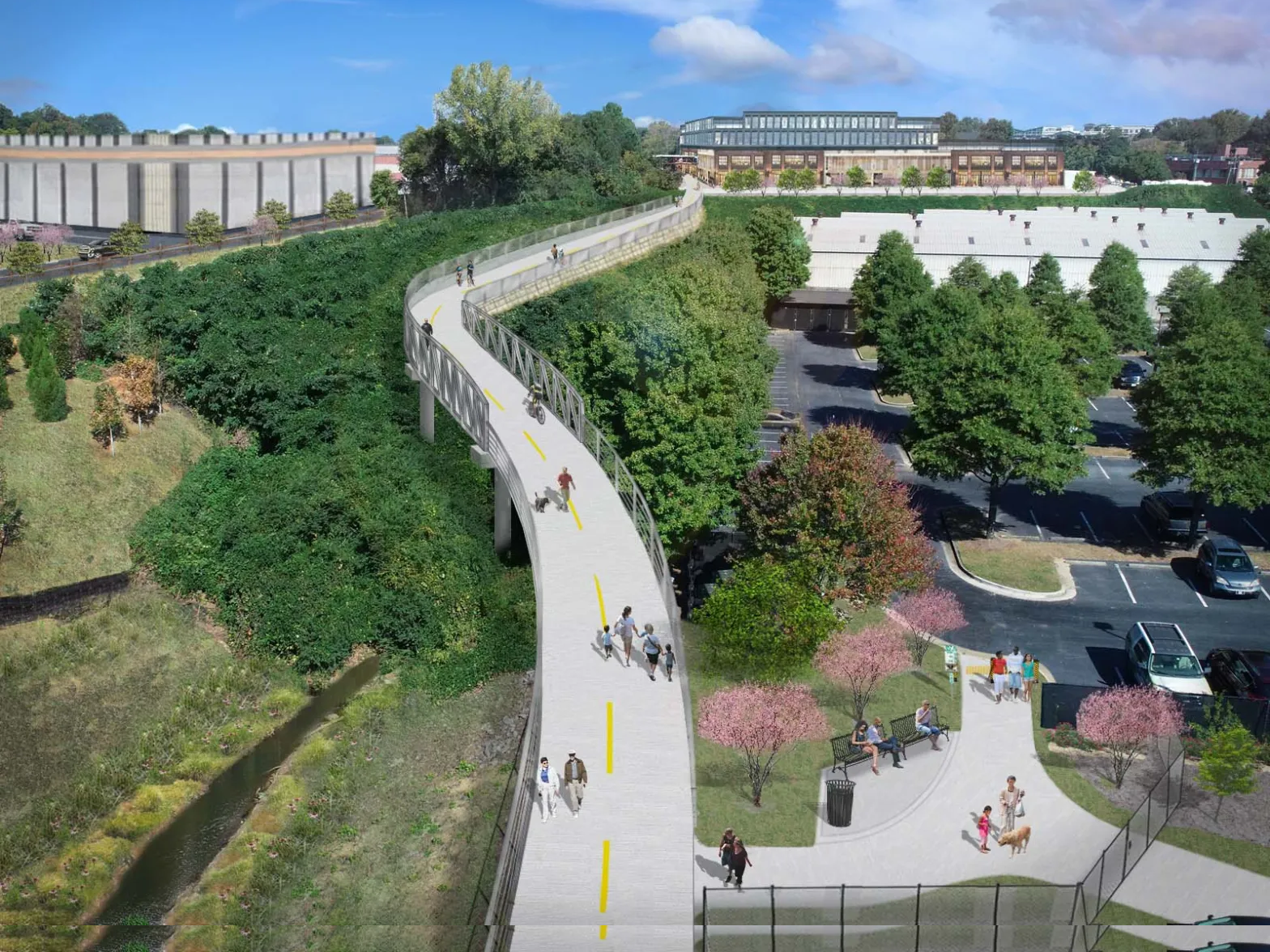
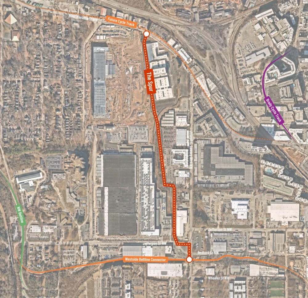
A map of “The Spur” trail planned to be built between West Marietta Street to the north and the Westside BeltLine Connector to the south. The cement trail, slated to be completed in 2025, would provide a safe off-road path for cyclists and pedestrians to travel from the Upper Westside to Downtown.
Credit: Upper Westside CID