Banner Image
Blog

Section Branding
Header Content
Galapagos Islands Street View On Google Earth
Primary Content
This week, Google was interviewed about a project in a far away land, the Galapagos Islands, an archipelago located on the equator around 600 miles off the coast of South America. The wild islands are teeming with life, some of which is pretty bizarre. Because the islands are so remote, the plant and animal species have had to evolve in ways to make-do with what’s available on the island. For example, there are 13 species of finches that inhabit the island, each one evolving from a single South American variety and filling a niche from digging bugs out of cacti to cracking tough nuts with a parrot-like beak. The Galapagos are also home to the only oceanic lizard, the marine iguana.
Can you imagine snorkeling around this reef?! This place is on my bucket list. In fact, if I don’t make it, I hope all of my friends travel there together to dump my ashes (sorry if we got too morbid just then). It’s an incredible place full of really weird stuff; and I like weird.
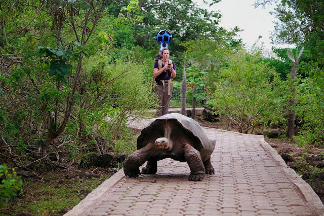
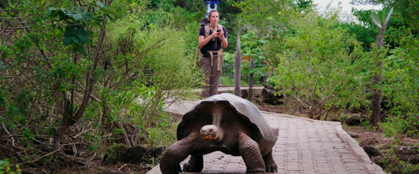
It seems it will be quite a while before I make this adventure a reality. Fortunately, Google is adding the “street view” of the Galapagos Islands to Google Maps. Since there aren’t any actual streets there, Google couldn’t use its famous camera cars. (There is technically a “Santa Cruz Highway” on the main island coursing through the National Park.) Instead, Google fashioned what must have been a technical wonder of a camera backpack. The 42-pound unit known as the Street View Trekker was worn and walked through the islands by a team of videographers and researchers.

This is the typical street view camera method.
While Google does sometimes do things for the cool/fun-factor (remember the Google Doodle homage to Pac-Man?), this has real scientific appeal, too. Researchers and students and nerds – ahem – will soon be able to explore the islands’ plant and animal life and even their structure using their favorite tech device while sitting in their favorite chair.

This videographer is living the dream!
For example, this image is of a trekker climbing out of a lava tunnel. Not all of the locations were on – or in -- land. That’s right, they also went into the sea to capture the unique Galapagos aquatic life. Can you imagine?! Soon we won’t have to. Google hasn’t said anything about when all of this footage will be available. The team spent 10 days on the islands collecting untold hours upon hours of footage. So, it may be awhile.
In the meantime, enjoy this interactive map of the Galapagos from NOVA, which includes photos and videos of the island and interactive panoramas. You can also follow along with the official Google Blog which has more photos and information posted as recently as yesterday.
Secondary Content
Author

Bottom Content


