Section Branding
Header Content
‘Sustainable future will depend on land.’ Group studies 50 years of agriculture, changes in land use
Primary Content
The Georgia Conservancy environmental organization highlighted the trends and changes to Georgia's agriculture and land at the first meeting of the Senate Study Committee on Preservation of Georgia's Farmlands on Tuesday, July 30, 2024.
As Georgia's population grows and land continues to develop, Georgia Conversancy focuses on whether Georgia can continue on its current trajectory in sustainability when considering land loss and the future of agriculture.
It asks, "How do we sustainably shape our state's future growth?" and "Are we asking too much of our land?"
In partnership with Georgia Tech's Center for Spatial Planning Analytics and Visualization, Georgia Conservancy looked at the past 50 years, from 1974 to 2021, of satellite imagery of Georgia's land.
"We arrived at a decision to look at the past to see what some of the past growth and change trends have been so that maybe that could inform us as the things to do, not to do, or do differently going forward," Georgia Conservancy President Katherine Moore said at the meeting.
In the Georgia Now and Forever initiative, Georgia Tech used satellite imagery to examine changes at the acre level, where they occurred, and what type of change they were.
Over time, the state grew economically and in population, leading to more land use.
"We have to ask ourselves how are we going to continue to grow, accommodate all of those folks and their needs, and keep this quality of life that we love in our state," Moore said.
"Our sustainable — the ability to carry on over time — economic, and environmental future here in Georgia will depend on the integrity of our land," she said.
"If we ever find ourselves in a resource crisis, we don't have enough land for housing," she said. "We are lacking the type of land we want for agriculture or for timber."
Georgia Conservancy lists the requirements for the use of land:
- House new residents
- Steward our natural recourses
- Grow our economy
- Build new infrastructure
- Provide food for our population
- Protect habitat and wildlife resources
- Improve quality of life
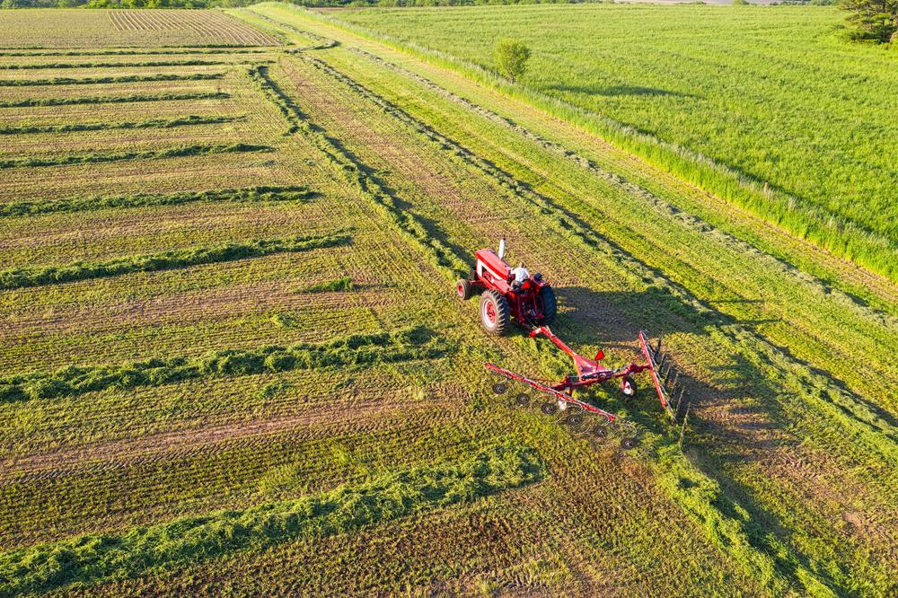
The presentation emphasized how developed land, the manufactured change to the natural landscape for agriculture, real estate, etc., affects agriculture and forestry.
. There are four subcategories of developed land that are:
- High intensity
- Med intensity
- Low intensity
- Developed open space
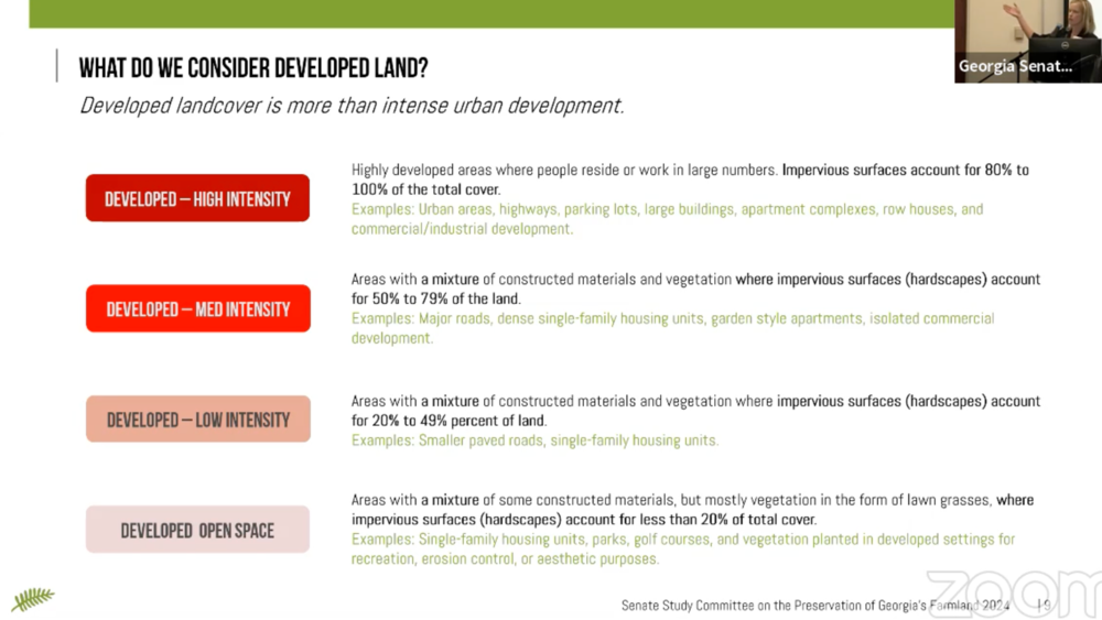
Moore revealed that although many farmers think that high-intensity development and solar farms contribute to the loss of agricultural land, most agricultural land is lost to low-intensity development.

The specific type of low-intensity taking up Georgia's developed land is residential and the growth of low-density residential is one of the biggest threats to agricultural land.
According to Georgia Conservancy, croplands and pastures support $70 billion of Georgia's agriculture industry, which is at risk of conversion.
Since 1974, 2.6 million acres of agricultural land have been converted to another landcover.

"It is impossible to be successful in thinking about conservation of our natural resources if we don't contemplate a method for addressing the very real housing needs that our state has," she said. "These must go together."
The Governor's Office of Planning and Budget projects that 2 million more people will add to Georgia's population by 2050.
Georgia Conservancy said that Georgia's land use change is out of sync with population growth, meaning that there are more people in the state than there is available land.
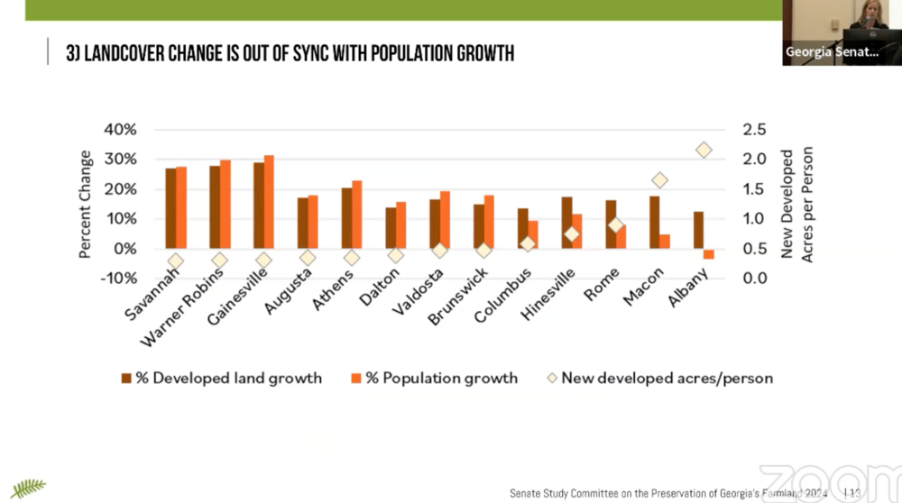
"Some communities, Warner Robins, Savannah, Gainesville, have grown in population, but their developed land is a little bit less," Moore said. That would beg us to wonder if they are doing things efficiently and providing for all those human needs of the land."
Other talking points Moore left with the study committee as it continues to discuss farmland preservation in Georgia over the next few months include::
- Identify the highest-priority natural resources and find the will to protect them.
- Every community has shaped our land consumption patterns, so every community, no matter its size, can influence our state’s future landscape.
- Locate new housing with walking distance of services
- Investing in walkability and public infrastructure and transit
- Can we curb the proliferation of low-intensity development?
The next meeting for the Senate Study Committee on Preservation of Georgia's Farmlands is scheduled fod Aug. 30.
Secondary Content
Author
Bottom Content
